Category:Maps of St Andrews
Jump to navigation
Jump to search
Media in category "Maps of St Andrews"
The following 16 files are in this category, out of 16 total.
-

-
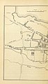
 410 of '(Our own country. Descriptive, historical, pictorial.)' (11298696574).jpg 1,202 × 1,097; 344 KB
-
 64 of '(Our own country. Descriptive, historical, pictorial.)' (11292513183).jpg 1,211 × 1,102; 355 KB
-
-

-

-
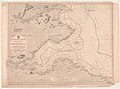 Admiralty Chart No 1407 Scotland E. Coast Sheet 1 Eyemouth to the Tay, Published 1842.jpg 11,061 × 8,211; 15.48 MB
-
 Andrew Forman benefices2.jpg 600 × 600; 99 KB
-
 Andrew Forman benefices3.jpg 588 × 629; 65 KB
-
 Location map Scotland St Andrews.png 2,091 × 1,382; 1.85 MB
-
 Ordnance Survey One-Inch Sheet 56 St Andrews and Kirkcaldy, Published 1957.jpg 8,278 × 9,952; 7.95 MB
-
 Ordnance Survey One-Inch Sheet 56 St Andrews and Kirkcaldy, Published 1969.jpg 8,287 × 9,866; 28.51 MB
-
 Ordnance Survey One-Inch Sheet 64 Dundee & St Andrews, Published 1945.jpg 14,463 × 10,617; 15.63 MB
-
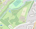 St Andrews Botanic Garden map.jpg 1,028 × 852; 224 KB
-
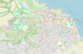
 St Andrews location.png 236 × 226; 47 KB
-
 StAndrewsScotland.png 1,008 × 786; 228 KB
.jpg)
%27_(11298696574).jpg)
%27_(11292513183).jpg)
.jpg)
.jpg)
.jpg)


