Category:Maps of Spuyten Duyvil, Bronx
Jump to navigation
Jump to search
Media in category "Maps of Spuyten Duyvil, Bronx"
The following 13 files are in this category, out of 13 total.
-
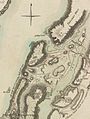 Forts Washington Tryon Cockhill.jpg 1,356 × 1,798; 1.13 MB
-

-
 Bromley Bronx Plate 39 publ. 1938 corr. 1957.jpg 9,339 × 6,437; 13.64 MB
-
 Bromley Bronx Plate 39 publ. 1938.jpg 8,818 × 6,161; 12.29 MB
-
 Bromley Bronx volume index publ. 1938.jpg 8,615 × 5,920; 14.02 MB
-
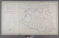
 Bronx topographical Sheet 05 publ. 1873.jpg 5,640 × 4,926; 7.84 MB
-
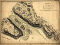
 Bronx, V. 13, Plate No. 1 (Map bounded by Harlem River.) NYPL2006757.tiff 6,713 × 8,958, 2 pages; 172.11 MB
-
-

-

-
-

-
 Spuyten Duyvil IRT map.jpg 200 × 272; 10 KB

_-_Bronx_County_-_Bronx_County_-_ED_3-1_to_2101_-_NARA_-_24066691_(page_3).jpg)


