Category:Maps of Spain in the 12th century
Appearance
English: This category is about the subject of  Spain 1101-1200 CE: History maps showing all or a substantial part of the territory of Spain as it was in the 12th century.
Contemporary old maps belong into: Category:12th-century maps of Spain and its subcategories. Maps that show history of the entire Iberian Peninsula, belong into: Category:Maps of the Iberian Peninsula in the 12th century.
Contemporary old maps belong into: Category:12th-century maps of Spain and its subcategories. Maps that show history of the entire Iberian Peninsula, belong into: Category:Maps of the Iberian Peninsula in the 12th century.
Media in category "Maps of Spain in the 12th century"
The following 12 files are in this category, out of 12 total.
-
Comtats catalans s. VIII-XII (modificat).jpg 1,882 × 1,992; 656 KB
-
Comtats catalans s. VIII-XII-es.svg 659 × 707; 439 KB
-
Conquistas de la Corona de Aragón.jpg 1,258 × 1,582; 1.12 MB
-
Reino de Pamplona Sancho III.svg 2,779 × 1,050; 525 KB
-
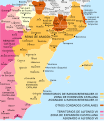
Territorio Ramon Berenguer IV-ar.svg 2,555 × 2,825; 1.01 MB
-
Territorio Ramon Berenguer IV-ca.svg 2,555 × 2,825; 499 KB
-
Territorio Ramon Berenguer IV-es.svg 2,555 × 2,825; 759 KB
-
Territorio Ramon Berenguer IV-v2-es.svg 2,462 × 2,003; 3.3 MB
-
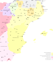
Tractat de Tudilén -1151-.svg 3,075 × 3,556; 206 KB
-
Tractat de Tudilén -1151-es.svg 3,075 × 3,556; 985 KB
-
TRATADO DE CAZOLA 1179.jpg 3,179 × 3,615; 788 KB


