Category:Maps of Spain
Appearance
cartography of Spain | |||||
| Upload media | |||||
| Subclass of |
| ||||
|---|---|---|---|---|---|
| Depicts | Spain | ||||
| Location |
| ||||
| |||||
- See also maps needing categories in Category:Unidentified maps
Use the appropriate category for maps showing all or a large part of Spain. See subcategories for smaller areas:
| If the map shows | Category to use |
|---|---|
| Spain on a recently created map | Category:Maps of Spain or its subcategories |
| Spain on a map created more than 70 years ago | Category:Old maps of Spain or its subcategories |
| the history of Spain on a recently created map | Category:Maps of the history of Spain or its subcategories |
| the history of Spain on a map created more than 70 years ago | Category:Old maps of the history of Spain or its subcategories |
Subcategories
This category has the following 31 subcategories, out of 31 total.
!
A
B
- Maps of borders of Spain (15 F)
E
- ECHO Daily Maps of Spain (20 F)
G
H
I
K
M
O
P
- Photographs of maps in Spain (24 F)
T
U
Pages in category "Maps of Spain"
The following 2 pages are in this category, out of 2 total.
Media in category "Maps of Spain"
The following 159 files are in this category, out of 159 total.
-
-Santa-Maria-De-Trassierra-Mapa-.png 755 × 566; 51 KB
-
65138-Cauterets-Géologie.png 7,015 × 4,960; 12.48 MB
-
Acuerdo Tripartito de Madrid.jpg 500 × 500; 28 KB
-
ADNNorafricanoPeninsulaIberica.jpg 1,003 × 592; 157 KB
-
Aguadulcealmeria.jpg 215 × 235; 16 KB
-
Aguadulceroquetas.jpg 213 × 237; 14 KB
-
Alcaldes de O Condado.png 1,080 × 2,307; 46 KB
-
Alcaldes O Condado.png 1,080 × 1,191; 45 KB
-
Altpallars.jpg 1,241 × 831; 232 KB
-
Areas of Parranda.png 169 × 156; 16 KB
-
Argentinian Population Distribution in Spain.svg 512 × 299; 2.32 MB
-
Avlo 20 25 59 468000.jpeg 4,032 × 3,024; 1.54 MB
-
B3Fqy-tasa-de-paro-provincial.png 1,240 × 1,020; 128 KB
-
Beterri-Buruntzako UEMAn dauden herrien mapa.png 1,280 × 960; 357 KB
-
Biglietti postali - primi 900 - mappe (51171133602).jpg 1,486 × 2,066; 1.14 MB
-
Caceres - Mapa municipal población.png 2,000 × 1,062; 507 KB
-
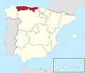
Cantabria in Spain (including Canarias).jpg 1,280 × 1,099; 135 KB
-
Casa de las Doñas 62.jpg 4,608 × 3,456; 3.94 MB
-
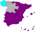
Ciudadanos autonomicas.svg 536 × 389; 382 KB
-
Colaboraciones SEAG.png 926 × 577; 490 KB
-
Corral de Calatrava municipality.png 3,342 × 2,312; 827 KB
-
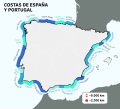
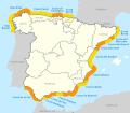
Costas de España y Portugal.svg 512 × 463; 317 KB
-
Daimiel mapa.jpg 544 × 381; 23 KB
-
Demarcaciones y unidades de carreteras.svg 578 × 374; 668 KB
-
Distribuidoras de electricidad en el mercado eléctrico español.svg 500 × 392; 768 KB
-
DIVIZAUN PROVINSIÁL ROMANU DAHULUK ISPÁNIA NIAN.png 511 × 358; 18 KB
-
Diócesis de San Felíu de Llobregat.PNG 534 × 373; 11 KB
-
Diócesis de Tarrasa.PNG 534 × 373; 11 KB
-
Erdialdeko sistema.png 790 × 600; 282 KB
-
ES + PT + islas.png 3,334 × 1,911; 1.92 MB
-
Espacio aéreo español.png 1,185 × 832; 1.1 MB
-
España-Europa (pulso histórico).svg 977 × 1,088; 1.3 MB
-
Euskal Herriko itsasargiak mapan kokatu ditugu.png 1,366 × 768; 460 KB
-
Euskal Herriko mendien mapa.png 1,063 × 744; 1.09 MB
-
FEVE map.png 827 × 230; 261 KB
-
FLII Spain.png 1,137 × 843; 1.14 MB
-
Foto aérea Villaviciosa de Odon 1968.jpg 17,831 × 16,571; 20.29 MB
-
Gdp-pps-spanish-regions-2022.png 1,240 × 944; 100 KB
-
Gender identity spain.svg 700 × 643; 446 KB
-
GRUPOS TERCERA DIVISION RFEF.png 300 × 261; 49 KB
-
H Terr.jpg 745 × 525; 37 KB
-
HEjs7-tasa-de-paro-por-cc-aa.png 1,240 × 966; 97 KB
-
Hertogdom Cantabria.jpg 1,202 × 1,150; 715 KB
-
Hipercor en España.jpg 1,033 × 1,054; 200 KB
-
Hipermercados E Leclerc.jpg 1,080 × 949; 195 KB
-
Hipermercados Eroski.jpg 1,080 × 1,208; 211 KB
-
Iberianndvi tmo 2023084 2023113 lrg.jpg 2,447 × 1,631; 2.55 MB
-
Iberianndvi tmo 2023084 2023113.jpg 720 × 480; 225 KB
-
Iberiar penintsula.jpg 843 × 596; 844 KB
-
Ibéria iha tinan 200 molok Kristu.png 644 × 599; 178 KB
-
Igeldoko parkeko tiroa asmatzeko atrakzio bat.jpg 1,280 × 960; 509 KB
-
Imatge distribució Eresus kollari.jpg 641 × 460; 65 KB
-
Karte Spanische Küsten.svg 880 × 770; 724 KB
-
L'Islam en la Península Ibèrica.jpg 2,559 × 1,819; 2.53 MB
-
Lista roja de patrimonio en peligro por CCAA.jpg 840 × 601; 222 KB
-
Lista verde del patrimonio por CCAA.jpg 509 × 407; 80 KB
-
LocationIznalloz R.png 529 × 435; 689 KB
-
Map eleciones restauracion.jpg 820 × 677; 40 KB
-
Map la encantada.png 1,016 × 602; 287 KB
-
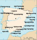
Map of Spain with state names in Gothic.png 329 × 352; 28 KB
-
Map-spain-monkeypox.svg 512 × 401; 407 KB
-
Mapa Autonómico Cs.svg 536 × 389; 382 KB
-
Mapa autonómico IU.svg 536 × 389; 382 KB
-
Mapa autonómico Podemos.svg 536 × 389; 382 KB
-
Mapa autonómico PP.svg 536 × 389; 382 KB
-
Mapa autonómico PSOE.svg 536 × 389; 382 KB
-
Mapa autonómico Vox.svg 536 × 389; 382 KB
-
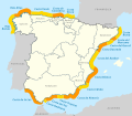
Mapa Costas de España.svg 880 × 770; 723 KB
-
Mapa de España con Alcalá de Henares.png 3,508 × 2,480; 443 KB
-
Mapa de España de cotas de inundación.png 369 × 261; 87 KB
-
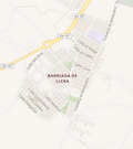
Mapa de la Barriada de Llera, Badajoz.png 473 × 533; 76 KB
-
Mapa de las experiencias de escuelas Freinet en la 2a República.png 1,096 × 648; 439 KB
-
Mapa de los 46 aeropuertos y 2 helipuertos que gestiona España.png 588 × 266; 55 KB
-
Mapa de los aeropuertos de Aena.png 588 × 266; 81 KB
-
Mapa de los paises andaluces.svg 644 × 458; 243 KB
-
Mapa de producció de cogombre a Espanya al 2006.png 5,171 × 3,236; 941 KB
-
Mapa desescalada fase 2 JPG.jpg 811 × 551; 64 KB
-
Mapa desescalada fase 2.png 811 × 551; 99 KB
-
Mapa INE.jpg 499 × 401; 53 KB
-
MAPA kom kan ikus.png 700 × 641; 118 KB
-
Mapa político de españa 2024.svg 1,067 × 879; 61 KB
-
Mapa producció cogombre 2006.png 1,280 × 720; 81 KB
-
Mapa provincias castellanas.png 1,421 × 1,002; 669 KB
-
Mapa Región Manchega sobre el mapa peninsular español.jpg 1,024 × 1,024; 65 KB
-
Mapa Topográfico Península Ibérica (Meseta Central).png 2,560 × 1,797; 3.32 MB
-
MapaCaminoLebaniego C.jpg 572 × 944; 143 KB
-
MaraSalvatruchaLocation.png 576 × 300; 13 KB
-
Merindad of Estella and La Ribera.png 440 × 461; 48 KB
-
MinutaMTN50-0558-Villaviciosa de Odon.jpg 12,425 × 8,975; 40.06 MB
-
Nazionalidaz d'España.PNG 853 × 593; 70 KB
-
NorthAfricanAdmixtureIberianPeninsula.jpg 968 × 597; 136 KB
-
O. hinojense-location-map.jpg 300 × 220; 24 KB
-
Parajes de Mues.png 663 × 907; 467 KB
-
PLANO LIÉBANA CAMINOS.jpg 862 × 884; 143 KB
-
Population density of Spain autonomous communities.png 5,402 × 4,099; 719 KB
-
Precio del crédito de grado en España por comunidad autónoma 2019-2020.png 1,366 × 968; 130 KB
-
Primeracat201314.png 891 × 861; 114 KB
-
Primeracat201415.png 891 × 861; 114 KB
-
Primeracat201516.png 891 × 861; 113 KB
-
Producció del cogombre a Espanya.png 5,308 × 3,369; 904 KB
-
Proiektuen Mapa.jpg 2,481 × 1,749; 264 KB
-
Proposed expansion of the De la Rosa surname.png 1,600 × 1,110; 2.07 MB
-
Provincia de Burgos relieve location map1.jpg 928 × 1,149; 123 KB
-
Provincia Eclesiástica de Barcelona.PNG 534 × 373; 11 KB
-
Provincia Eclesiástica de Zaragoza.PNG 534 × 373; 11 KB
-
Provincias (España).jpg 644 × 458; 33 KB
-
Provincias de españa actuales.svg 800 × 659; 214 KB
-
Provincias españa actuales.svg 800 × 659; 176 KB
-
Provincias españa.svg 800 × 659; 214 KB
-
Regiones militares 1893.png 1,024 × 663; 169 KB
-
Regiones militares 1896.png 1,024 × 663; 170 KB
-
Regiones militares 1904.png 1,024 × 663; 169 KB
-
Regiones militares 1907.png 1,024 × 663; 171 KB
-
Regiones militares 1918.png 1,024 × 663; 168 KB
-
Regiones militares 1960.png 2,980 × 1,886; 658 KB
-
Regiones militares 1984.png 1,024 × 663; 171 KB
-
Regiones militares 1997.png 1,024 × 663; 172 KB
-
Reino de León en 'Spain and Portugal', de Smith (1819).jpg 554 × 656; 177 KB
-
RNC boi.jpg 1,032 × 901; 291 KB
-
RNC dels Ports1.jpg 2,412 × 2,252; 1.28 MB
-
RNC vs ENPES.jpg 2,012 × 1,684; 995 KB
-
Rosario abasto.png 720 × 1,600; 1.15 MB
-
Segovia.png 310 × 138; 13 KB
-
Siège d'Oran (1693).jpg 630 × 480; 112 KB
-
SolarGIS-Solar-map-Spain-es.png 1,842 × 2,106; 2.91 MB
-
Spain - DPLA - 74a205f86f6331f3aa172185f8f07506.jpg 3,274 × 2,548; 1.26 MB
-
Spain - DPLA - b4f7b5eef4233cd65392077c96ccaf0b.jpg 2,568 × 3,298; 6.52 MB
-
Spain disputed w1 countrymap.svg 1,000 × 1,000; 12 KB
-
Spain DNI Solar-resource-map GlobalSolarAtlas World-Bank-Esmap-Solargis.png 1,842 × 2,106; 1.07 MB
-
Spain DNI Solar-resource-map lang-ES GlobalSolarAtlas World-Bank-Esmap-Solargis.png 1,842 × 2,106; 2.93 MB
-
Spain map in Japanese.gif 328 × 353; 24 KB
-
Spain met.png 1,705 × 1,185; 208 KB
-
Spain-Location-Map-Nepali.png 500 × 500; 75 KB
-
Spain.d-map.png 4,297 × 3,257; 2.63 MB
-
SuperCor en España 2.jpg 1,080 × 1,231; 215 KB
-
SuperCor en España 3.jpg 1,080 × 1,262; 209 KB
-
SuperCor en España.jpg 1,920 × 1,920; 358 KB
-
SuperCor en España.png 4,006 × 6,000; 1.13 MB
-
Tasa-de-paro-provincial-ivt-2024.png 1,220 × 906; 116 KB
-
Time in Spain.png 1,059 × 980; 108 KB
-
Trastamara Orte.jpg 5,279 × 3,825; 287 KB
-
Tribunales Militares Territoriales España.svg 578 × 374; 1.2 MB
-
Tuber generoaren hedapena espainian.jpg 640 × 418; 44 KB
-
YJbrB-tasa-de-paro-provincial-ivt-2023.png 1,240 × 1,018; 143 KB
-
Zuberoa (Municipios 2024).png 8,705 × 11,729; 3.62 MB
-
Áreas urbanizadas en España.jpg 1,708 × 1,267; 529 KB
-
Βαλλαδόλιδον.png 1,197 × 1,027; 1.85 MB
-
Βαρκινών.png 1,197 × 1,027; 1.84 MB
-
Οὐαλεντία.png 1,197 × 1,027; 1.85 MB
-
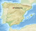
Παλλαντία.png 1,197 × 1,027; 1.84 MB


