Category:Maps of South and Southeast Asia
Jump to navigation
Jump to search
Subcategories
This category has only the following subcategory.
A
Media in category "Maps of South and Southeast Asia"
The following 33 files are in this category, out of 33 total.
-
 Asia 600ad 2.jpg 1,984 × 1,276; 963 KB
-
 Asia 323bc.jpg 2,040 × 1,169; 733 KB
-
 AsiaAltitude.png 2,592 × 2,592; 1.11 MB
-
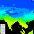 AsiaMaxTemp.png 600 × 600; 608 KB
-
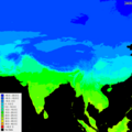 AsiaMeanTemp.png 600 × 600; 556 KB
-
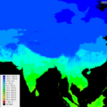 AsiaMinTemperature.png 600 × 600; 505 KB
-
 AsiaMonthlyPrecipitation.png 600 × 600; 298 KB
-
 AsiaMonthlyPrecipitation1.png 600 × 600; 418 KB
-
 Bamboo Curtain.PNG 300 × 213; 6 KB
-
 Bamboo Curtain.svg 360 × 280; 317 KB
-
 Chamagudao (no names).png 1,183 × 869; 1.77 MB
-
 Chamagudao.png 1,183 × 869; 1.74 MB
-
 Ecozone Indomalaya.svg 940 × 415; 1.36 MB
-
 Ecozone-Biocountries-Indomalaya.svg 1,052 × 744; 337 KB
-
 Ecozone-Biocountry-Indomalaya.svg 1,054 × 465; 1.79 MB
-
 Hinduism Expansion in Asia 2023.svg 512 × 382; 780 KB
-
 Hinduism Expansion in Asia de.svg 1,060 × 791; 845 KB
-
 Hinduism Expansion in Asia-es.svg 512 × 382; 1.28 MB
-
 Hinduism Expansion in Asia-hu.svg 512 × 382; 824 KB
-
 Hinduism Expansion in Asia-id.svg 512 × 382; 779 KB
-
 Hinduism Expansion in Asia-pt.svg 512 × 382; 826 KB
-
 Hinduism Expansion in Asia-zh-hans.svg 512 × 382; 779 KB
-
 Hinduism Expansion in Asia.svg 512 × 382; 769 KB
-
 Indes orientales.JPG 956 × 681; 53 KB
-
 India and South Asia Köppen climate map with legend.jpg 545 × 537; 60 KB
-
 Indian cultural zone.svg 940 × 423; 1.77 MB
-
 Indosphere.PNG 1,427 × 628; 37 KB
-
 Indosphere2.PNG 1,427 × 628; 48 KB
-
 Kamarupa 7th-8th Century AD.jpg 960 × 720; 485 KB
-
 Kamarupa 7th-8th Century Cities.jpg 960 × 720; 493 KB
-
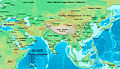
 Tea-Horse-Road 2.png 800 × 588; 1.16 MB
-
 Tea-Horse-Road.png 1,183 × 869; 1.73 MB
-
 Tee-Pferde-Straße.png 1,183 × 869; 1.73 MB


.png)


