Category:Maps of Sonnac (Aveyron)
Jump to navigation
Jump to search
Wikimedia category | |||||
| Upload media | |||||
| Instance of | |||||
|---|---|---|---|---|---|
| Category combines topics | |||||
| Sonnac | |||||
commune in Aveyron, France .jpg)  _OSM_01.png) | |||||
| Instance of | |||||
| Location |
| ||||
| Population |
| ||||
| Area |
| ||||
| Elevation above sea level |
| ||||
| Different from | |||||
| official website | |||||
 | |||||
Media in category "Maps of Sonnac (Aveyron)"
The following 10 files are in this category, out of 10 total.
-
 12272-Sonnac-Arron.png 3,057 × 2,480; 1.26 MB
-
 12272-Sonnac-cadastre.svg 961 × 744; 5.63 MB
-
 12272-Sonnac-Canton.png 3,057 × 2,480; 1.25 MB
-
 12272-Sonnac-EPCI.png 3,057 × 2,480; 1.25 MB
-
 12272-Sonnac-Hydro.png 3,519 × 2,480; 2.59 MB
-
 12272-Sonnac-Sols.png 3,507 × 2,480; 2.87 MB
-
 12272-Sonnac-Zone inondable.svg 1,070 × 744; 3.96 MB
-
 Map commune FR insee code 12272.png 756 × 605; 53 KB
-
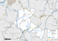
 Sonnac (Aveyron) OSM 01.png 417 × 488; 123 KB
-
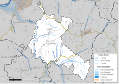
 Sonnac (Aveyron) OSM 02.png 417 × 488; 258 KB


_OSM_02.png)