Category:Maps of Skorenovac
Jump to navigation
Jump to search
Media in category "Maps of Skorenovac"
The following 5 files are in this category, out of 5 total.
-
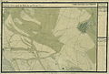 Banat Josephinische Landaufnahme pg164.jpg 8,504 × 5,760; 26.63 MB
-
 Skorenovac Map 4.jpg 2,835 × 2,071; 1.13 MB
-
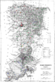
 Temes county administrative map.jpg 1,768 × 2,629; 879 KB
-
 Temes county map.jpg 1,650 × 2,115; 499 KB
-
 Temes ethnic map.png 1,768 × 2,629; 3.54 MB


