Category:Maps of Silleda
Jump to navigation
Jump to search
Municipalities in the province of Pontevedra: Agolada · Arbo · Baiona · Barro · Bueu · Caldas de Reis · Cambados · Campo Lameiro · Cangas · A Cañiza · Catoira · Cerdedo-Cotobade · Covelo · Crecente · Cuntis · Dozón · A Estrada · Forcarei · Fornelos de Montes · Gondomar · O Grove · A Guarda · A Illa de Arousa · Lalín · A Lama · Marín · Meaño · Meis · Moaña · Mondariz · Mondariz-Balneario · Moraña · Mos · As Neves · Nigrán · Oia · Pazos de Borbén · Poio · Ponte Caldelas · Ponteareas · Pontecesures · Pontevedra · O Porriño · Portas · Redondela · Ribadumia · Rodeiro · O Rosal · Salceda de Caselas · Salvaterra de Miño · Sanxenxo · Silleda · Soutomaior · Tomiño · Tui · Valga · Vigo · Vila de Cruces · Vilaboa · Vilagarcía de Arousa · Vilanova de Arousa
Media in category "Maps of Silleda"
The following 5 files are in this category, out of 5 total.
-
 Karte Gemeinde Silleda 2022.png 3,000 × 3,328; 1.03 MB
-
 MTN25-0121c4-1994-Silleda.jpg 7,775 × 5,512; 7.98 MB
-
 MTN25-0121c4-2002-Silleda.jpg 7,775 × 5,512; 10.33 MB
-
 MTN25-0121c4-2010-Silleda.jpg 7,874 × 5,161; 10.55 MB
-
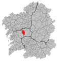 Situacion Silleda.PNG 956 × 1,008; 84 KB


