Category:Maps of Sers (Charente)
Jump to navigation
Jump to search
Wikimedia category | |||||
| Upload media | |||||
| Instance of | |||||
|---|---|---|---|---|---|
| Category combines topics | |||||
| Sers | |||||
commune in Charente, France  Церковь Сен-Пьер  | |||||
| Instance of | |||||
| Location |
| ||||
| Population |
| ||||
| Area |
| ||||
| Different from | |||||
| official website | |||||
 | |||||
Media in category "Maps of Sers (Charente)"
The following 5 files are in this category, out of 5 total.
-
 16368-Sers-argile.jpg 3,057 × 2,480; 595 KB
-
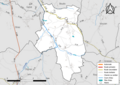 16368-Sers-Routes-Hydro.png 3,507 × 2,480; 1.9 MB
-
 16368-Sers-Routes-Hydro.svg 1,056 × 744; 3.09 MB
-
 16368-Sers-ZNIEFF1.png 5,866 × 4,133; 9.54 MB
-
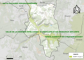 16368-Sers-ZNIEFF2.png 5,866 × 4,133; 9.45 MB


