Category:Maps of Sens-Beaujeu
Jump to navigation
Jump to search
Wikimedia category | |||||
| Upload media | |||||
| Instance of | |||||
|---|---|---|---|---|---|
| Category combines topics | |||||
| Sens-Beaujeu | |||||
commune in Cher, France    | |||||
| Instance of | |||||
| Location | |||||
| Located in or next to body of water | |||||
| Street address |
| ||||
| Population |
| ||||
| Area |
| ||||
 | |||||
Media in category "Maps of Sens-Beaujeu"
The following 7 files are in this category, out of 7 total.
-
 18249-Sens-Beaujeu-argile.png 3,057 × 2,480; 3.23 MB
-
 18249-Sens-Beaujeu-Hydro.jpeg 5,846 × 4,133; 1.96 MB
-
 18249-Sens-Beaujeu-Sols.png 3,270 × 2,598; 1.85 MB
-
 Carte de Sens-Beaujeu.png 2,384 × 1,684; 1.36 MB
-
 Extrait du plan du cadastre napoléonien de Sens-Beaujeu.png 2,434 × 1,650; 4.6 MB
-
 Map commune FR insee code 18249.png 756 × 605; 48 KB
-
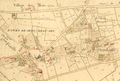
 Plan du bourg de Sens-Beaujeu.png 2,384 × 1,684; 746 KB


