Category:Maps of Senkaku Islands
Jump to navigation
Jump to search
English: Category for maps of Senkaku Islands
日本語:尖閣諸島の地図に関するカテゴリ
Wikimedia category | |||||
| Upload media | |||||
| Instance of | |||||
|---|---|---|---|---|---|
| Category combines topics | |||||
| Senkaku Islands | |||||
group of islands in East Asia   | |||||
| Pronunciation audio | |||||
| Instance of | |||||
| Location |
| ||||
| Located in or next to body of water | |||||
| Significant event |
| ||||
| Population |
| ||||
| Area |
| ||||
| Elevation above sea level |
| ||||
| official website | |||||
 | |||||
Media in category "Maps of Senkaku Islands"
The following 43 files are in this category, out of 43 total.
-
 1786年中国往琉球海路图2.jpg 2,130 × 1,450; 325 KB
-
 1971) East China Sea (30583779680).jpg 3,270 × 4,258; 15.07 MB
-
 Bei nanxiaodao.PNG 547 × 463; 21 KB
-
 Beiandnan Island Geo.jpg 550 × 370; 14 KB
-
 Beiyu Island Geo.png 550 × 375; 51 KB
-
 Chiwei Island Geo.jpg 550 × 374; 13 KB
-
 Chiweiyu.PNG 393 × 251; 10 KB
-
 Diaoyu Island Geo.png 550 × 374; 80 KB
-
 Diaoyu Islands ja.png 1,857 × 450; 28 KB
-
 Diaoyu Islands zh-tw.png 1,857 × 450; 41 KB
-
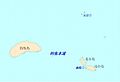
 Diaoyu Islands.png 1,857 × 450; 111 KB
-
 Diaoyu Strait Geo.jpg 550 × 375; 13 KB
-
 Diaoyutai senkaku detail.png 756 × 184; 3 KB
-
 Diaoyutai senkaku.png 1,165 × 585; 46 KB
-
 Diaoyutai.PNG 1,035 × 591; 38 KB
-
 E0171497 7481621.jpg 900 × 772; 364 KB
-
 East China sea digging map.svg 459 × 448; 647 KB
-
 Huangwei Island Geo.jpg 550 × 371; 11 KB
-
 Huangweiyu.PNG 475 × 360; 16 KB
-
 Islands-inset.jpg 500 × 351; 116 KB
-
 Map of Senkaku Islands.svg 1,000 × 1,000; 39 KB
-
 PRCmap-senkakuislands.jpg 1,478 × 908; 242 KB
-

-
 Senkaku Diaoyu Tiaoyu Islands-zh.png 900 × 900; 366 KB
-
 Senkaku Diaoyu Tiaoyu Islands.png 900 × 900; 284 KB
-
 Senkaku Islands topomap.png 1,299 × 829; 98 KB
-
 Senkaku Mole area.png 272 × 328; 4 KB
-
 Senkaku Okinawa Reversion 1972.jpg 840 × 554; 173 KB
-
 Senkaku-Diaoyu-Tiaoyu-Islan.jpg 480 × 313; 175 KB
-
 Senkaku-Diaoyu-Tiaoyu-Island-no.jpg 1,440 × 940; 706 KB
-
 The fishing area of Japan-Taiwan fishery agreement 20130414.svg 521 × 495; 232 KB
-
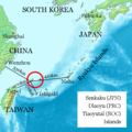
 Tokara and Senkaku Islands Map.jpg 3,462 × 2,683; 817 KB
-
 Txu-oclc-6654394-ng-51-6th-ed.jpg 5,000 × 4,715; 10.27 MB
-
 Txu-oclc-6900707-ng51-15 Uotsuri.png 903 × 1,037; 1.78 MB
-
 Txu-oclc-6900707-ng51-15.jpg 5,000 × 3,777; 5.31 MB
-
 Txu-oclc-6900707-ng51-16.jpg 5,000 × 3,797; 4.83 MB
-
 Txu-pclmaps-oclc-22834566 h-12c.jpg 9,190 × 6,725; 9.82 MB
-
 Txu-pclmaps-oclc-6618306-senkaku-gunto-13.jpg 3,911 × 4,376; 1.81 MB
-
 Uotsuri-shima geo 1900.jpg 975 × 650; 54 KB
-
 Uotsurijima Map.jpg 3,431 × 2,645; 307 KB
-
 Острови Сенкаку.PNG 717 × 296; 18 KB
-
 中山传信录往琉球2.jpg 929 × 844; 436 KB
-
 中山传信录往琉球A.jpg 911 × 845; 464 KB

_East_China_Sea_(30583779680).jpg)


.jpg)


