Category:Maps of Sendai
Jump to navigation
Jump to search
日本語: 仙台市の地図
Subcategories
This category has only the following subcategory.
P
Media in category "Maps of Sendai"
The following 44 files are in this category, out of 44 total.
-
Actual inundation areas were much larger than predicted.jpg 1,910 × 1,457; 765 KB
-
Aoba-ku in Sendai City.svg 600 × 452; 9 KB
-
Asuto Nagamachi Land Use Plan Map 2007-05-18.svg 272 × 701; 222 KB
-
Izumi-ku in Sendai City.svg 600 × 452; 9 KB
-
JP Miyagi Sendai City Location.png 1,496 × 1,009; 48 KB
-
Map of Japan with highlight on Sendai city.svg 1,024 × 1,024; 15 KB
-
Map of Sendai Castle (Miyagi Prefectural Library).jpg 392 × 484; 221 KB
-
Miyagi-Sendai-City 5.jpg 1,000 × 897; 98 KB
-
Miyagino-ku in Sendai City.svg 600 × 452; 9 KB
-
Relocation project in Sendai City.jpg 1,215 × 1,384; 232 KB
-
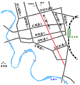
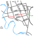
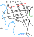
Sendai City major streets Bansui-dori.svg 695 × 737; 93 KB
-
Sendai City major streets Ekimae-dori.svg 695 × 737; 94 KB
-
Sendai City major streets Higashi-Nibancho-dori.svg 695 × 737; 94 KB
-
Sendai City major streets Itsutsubashi-dori.svg 652 × 691; 94 KB
-
Sendai City major streets Nishikoen-dori.svg 652 × 691; 94 KB
-
Sendai City major streets-Aoba-dori.svg 695 × 737; 94 KB
-
Sendai City major streets-Jozenji-dori.svg 695 × 737; 94 KB
-
Sendai City major streets-Kitamemachi-dori.svg 695 × 737; 94 KB
-
Sendai City major streets-Minamimachi-dori.svg 695 × 737; 95 KB
-
Sendai City major streets.svg 695 × 737; 136 KB
-
Sendai in Miyagi Prefecture Ja.svg 484 × 538; 18 KB
-
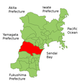
Sendai in Miyagi Prefecture.png 901 × 901; 41 KB
-
Sendai map circa 1930.PNG 1,098 × 1,661; 1.29 MB
-
Sendai Map.jpg 912 × 707; 178 KB
-
Sendai Miyagi Map.png 600 × 600; 80 KB
-
Sendai wards.png 600 × 380; 38 KB
-
Sendai-city-Aoba-ku.png 253 × 222; 4 KB
-
Sendai-city-Izumi-ku.png 253 × 222; 4 KB
-
Sendai-city-Miyagino-ku.png 253 × 222; 4 KB
-
Sendai-city-Taihaku-ku.png 253 × 222; 4 KB
-
Sendai-city-Wakabayashi-ku.png 253 × 222; 4 KB
-
Sendai-city.PNG 253 × 222; 7 KB
-
Sendai-city.png 253 × 222; 4 KB
-
Sendai-ku.PNG 97 × 53; 1 KB
-
Sendai-Miyagi.png 253 × 222; 7 KB
-
Shadow picture of Aoba-ku, Sendai city.svg 538 × 444; 97 KB
-
Shadow picture of Izumi-ku, Sendai city.svg 783 × 597; 69 KB
-
Shadow picture of Taihaku-ku, Sendai city.svg 1,122 × 622; 109 KB
-
Taihaku-ku in Sendai City.svg 600 × 452; 9 KB
-
Wakabayashi-ku in Sendai City.svg 600 × 452; 9 KB
-
Wards of Sendai Ja.svg 600 × 452; 9 KB
-
仙台城下絵図.jpg 299 × 262; 149 KB
-
仙台市青葉区町丁別地図.png 4,560 × 3,840; 884 KB
-
蒲生競馬場昭和20年4月.jpg 1,495 × 1,133; 462 KB


