Category:Maps of Scotts Bluff County, Nebraska
Jump to navigation
Jump to search
Counties of Nebraska: Adams · Antelope · Arthur · Banner · Blaine · Boone · Box Butte · Boyd · Brown · Buffalo · Burt · Butler · Cass · Cedar · Chase · Cherry · Cheyenne · Clay · Colfax · Cuming · Custer · Dakota · Dawes · Dawson · Deuel · Dixon · Dodge · Douglas · Dundy · Fillmore · Franklin · Frontier · Furnas · Gage · Garden · Garfield · Gosper · Grant · Greeley · Hall · Hamilton · Harlan · Hayes · Hitchcock · Holt · Hooker · Howard · Jefferson · Johnson · Kearney · Keith · Keya Paha · Kimball · Knox · Lancaster · Lincoln · Logan · Loup · Madison · McPherson · Merrick · Morrill · Nance · Nemaha · Nuckolls · Otoe · Pawnee · Perkins · Phelps · Pierce · Platte · Polk · Red Willow · Richardson · Rock · Saline · Sarpy · Saunders · Scotts Bluff · Seward · Sheridan · Sherman · Sioux · Stanton · Thayer · Thomas · Thurston · Valley · Washington · Wayne · Webster · Wheeler · York
Wikimedia category | |||||
| Upload media | |||||
| Instance of | |||||
|---|---|---|---|---|---|
| Category combines topics | |||||
| Scotts Bluff County | |||||
county in Nebraska, United States  Здание окружного суда в городе Гиринг  | |||||
| Instance of | |||||
| Named after | |||||
| Location | Nebraska | ||||
| Capital | |||||
| Inception |
| ||||
| Population |
| ||||
| Area |
| ||||
| Different from | |||||
| official website | |||||
 | |||||
Media in category "Maps of Scotts Bluff County, Nebraska"
The following 15 files are in this category, out of 15 total.
-
 Map of Nebraska highlighting Panhandle.svg 7,414 × 3,411; 34 KB
-
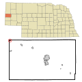
 Map of Nebraska highlighting Scotts Bluff County.svg 2,471 × 1,137; 26 KB
-
 Map of Nebraska highlighting Scottsbluff Micropolitan Statistical Area.svg 7,414 × 3,411; 34 KB
-
 Map of Nebraska highlighting the Scottsbluff Micropolitan Statistical Area.svg 7,414 × 3,411; 37 KB
-

-
-

-

-

-

-

-

-

-

-
 Scotts Bluff County Road Map.png 2,794 × 1,552; 230 KB


