Category:Maps of Scottish districts 1975
Jump to navigation
Jump to search
| NO WIKIDATA ID FOUND! Search for Maps of Scottish districts 1975 on Wikidata | |
| Upload media |
Subcategories
This category has only the following subcategory.
Media in category "Maps of Scottish districts 1975"
The following 40 files are in this category, out of 40 total.
-
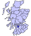
Eastwood District, 1980.svg 262 × 357; 2.71 MB
-
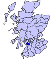
Monklands District, 1980.svg 262 × 357; 2.71 MB
-
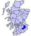
North-East Fife District, 1980.svg 262 × 357; 2.71 MB
-
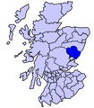
Scot1975Angus.png 200 × 229; 30 KB
-
Scot1975AnnEsk.png 200 × 229; 30 KB
-
Scot1975BadStrath.png 200 × 229; 30 KB
-
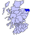
Scot1975BanffBuchan.png 200 × 229; 30 KB
-
Scot1975BearMiln.png 200 × 229; 30 KB
-
Scot1975Clackmannan.png 200 × 229; 30 KB
-
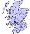
Scot1975Clydesdale.png 200 × 229; 30 KB
-
Scot1975CumbKils.png 200 × 229; 30 KB
-
Scot1975CumDoon.png 200 × 229; 30 KB
-
Scot1975Cunninghame.png 200 × 229; 30 KB
-
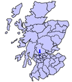
Scot1975Dumbarton.png 200 × 229; 30 KB
-
Scot1975Dunfermline.png 200 × 229; 30 KB
-
Scot1975Eastwood.png 200 × 229; 30 KB
-
Scot1975EKilbride.png 200 × 229; 30 KB
-
Scot1975EttLaud.png 200 × 229; 30 KB
-
Scot1975Gordon.png 200 × 229; 30 KB
-
Scot1975Hamilton.png 200 × 229; 30 KB
-
Scot1975Inverness.png 200 × 229; 30 KB
-
Scot1975KilmLoud.png 200 × 229; 30 KB
-
Scot1975KinDee.png 200 × 229; 30 KB
-
Scot1975Kirkcaldy.png 200 × 229; 30 KB
-
Scot1975KyleCarrick.png 200 × 229; 30 KB
-
Scot1975Lochaber.png 200 × 229; 30 KB
-
Scot1975Monklands.png 200 × 229; 30 KB
-
Scot1975Motherwell.png 200 × 229; 30 KB
-
Scot1975Nairn.png 200 × 229; 30 KB
-
Scot1975NEFife.png 200 × 229; 30 KB
-
Scot1975Nithsdale.png 200 × 229; 30 KB
-
Scot1975Roxburgh.png 200 × 229; 30 KB
-
Scot1975SkyeLoch.png 200 × 229; 30 KB
-
Scot1975Stewartry.png 200 × 229; 30 KB
-
Scot1975Strathkelvin.png 200 × 229; 30 KB
-
Scot1975Tweeddale.png 200 × 229; 30 KB
-
Scot1975Wigtown.png 200 × 229; 30 KB
-
Scotland 1974 Administrative Map.png 2,000 × 3,476; 1.42 MB
-
ScotlandDumfriesLieut.png 200 × 229; 30 KB
-
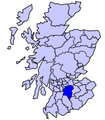
ScotlandLanarkshireLieut.png 200 × 229; 30 KB


