Category:Maps of Savo island
Jump to navigation
Jump to search
Media in category "Maps of Savo island"
The following 8 files are in this category, out of 8 total.
-
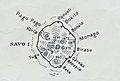 Savo Island 1942 map.jpg 776 × 524; 69 KB
-
 7126 Solomon Islands Guadalcanal Island Doma 50K 7730 II master (cropped).jpg 2,973 × 3,451; 4.47 MB
-
 7126 Solomon Islands Guadalcanal Island Doma 50K 7730 II master.jpg 7,552 × 6,608; 17.59 MB
-
 Admiralty Chart No 1469 Guadalcanal and Florida Island, Published 1893, Large Corrections 1932.jpg 16,135 × 11,064; 43.25 MB
-
 OSM 2023 Solomons Central.png 2,202 × 706; 378 KB
-
 Savo 1958 topo map nla.obj-540256336 (cropped).jpg 3,462 × 3,515; 4.38 MB
-
 Savo Island 1965 topo 25K map boundaries.jpg 4,720 × 4,612; 12.82 MB
-
 Savo Island 1965 Topo 25K map.jpg 4,720 × 4,612; 12.76 MB

.jpg)


.jpg)

