Category:Maps of Sasanian provinces
Jump to navigation
Jump to search
Media in category "Maps of Sasanian provinces"
The following 16 files are in this category, out of 16 total.
-
 Map of the Sasanian province of Pars fa.svg 2,865 × 2,496; 6.39 MB
-
 Map of the Sasanian province of Pars.svg 2,865 × 2,496; 6.69 MB
-
 Map of the Sasanian province Spahan, also known as Parthau.svg 2,294 × 1,371; 2.22 MB
-
 Northern Mesopotamia during the late Sasanian era.svg 760 × 600; 983 KB
-
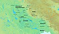
 Sakastan Sasanian era.png 1,788 × 921; 2.06 MB
-
 Sasanian Asoristan and its surroundings.svg 700 × 650; 704 KB
-
 Sasanian Garmekan.svg 1,138 × 788; 1.69 MB
-
 Sasanian Gurgan.svg 1,485 × 923; 1.25 MB
-
 Sasanian Iraq.png 554 × 401; 211 KB
-
 Sasanian Khuzestan.svg 450 × 450; 621 KB
-
 Sasanian Kirman.svg 4,254 × 3,513; 7.73 MB
-
 Sasanian province of Harev.png 1,240 × 695; 1.15 MB
-
 Sasanian province of Pars.png 1,193 × 918; 932 KB
-
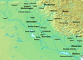
 Southeastern part of the Sasanian Empire.jpg 1,165 × 696; 1.05 MB
-
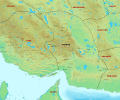
 Southwestern part of the Sasanian Empire.jpg 1,788 × 1,041; 2.98 MB
-
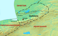
 The provinces of Sakastan, Paradan, Turan, Makuran and Hind in the early Sasanian era.svg 2,778 × 1,860; 1.68 MB


