Category:Maps of Sarcelles
Jump to navigation
Jump to search
Wikimedia category | |||||
| Upload media | |||||
| Instance of | |||||
|---|---|---|---|---|---|
| Category combines topics | |||||
| Sarcelles | |||||
commune in Val-d'Oise, France  .svg) _-_2023-11-19_-_1.jpg)  | |||||
| Instance of | |||||
| Location |
| ||||
| Head of government |
| ||||
| Population |
| ||||
| Area |
| ||||
| Elevation above sea level |
| ||||
| official website | |||||
 | |||||
Media in category "Maps of Sarcelles"
The following 15 files are in this category, out of 15 total.
-
 95585-Sarcelles-Hydro.jpeg 5,846 × 4,133; 4.17 MB
-
 95585-Sarcelles-Sols.png 3,270 × 2,598; 6.42 MB
-
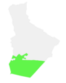
 Map commune FR insee code 95585.png 756 × 605; 66 KB
-
 Plan de ville de Sarcelles.jpg 3,814 × 4,724; 2.4 MB
-
 Plan des quartiers du grand ensemble.jpg 1,256 × 915; 515 KB
-
 Sarcelles - carte de France dite d Etat-Major.jpg 590 × 528; 358 KB
-
 Sarcelles Limite communale.jpg 958 × 577; 212 KB
-
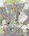
 Sarcelles map.png 1,022 × 955; 315 KB
-
 Sarcelles OSM 01.png 645 × 803; 424 KB
-
 Sarcelles OSM 02.png 647 × 798; 641 KB
-
 Sarcelles-Carte de Cassini1.jpg 428 × 393; 181 KB
-
 萨塞勒ZFU街区地图.png 511 × 637; 16 KB
-
 萨塞勒ZUP街区地图.png 471 × 624; 20 KB
-
 萨塞勒ZUS街区地图.png 491 × 629; 17 KB
-
 萨塞勒街区底图.png 429 × 608; 42 KB


