Category:Maps of Saptari District
Jump to navigation
Jump to search
Media in category "Maps of Saptari District"
The following 17 files are in this category, out of 17 total.
-
 Dakneshwori Municipality.jpg 3,509 × 2,481; 426 KB
-
 Locator map of Saptari District.png 1,280 × 758; 154 KB
-
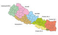
 Map of Village Development Committees in Saptari District, Nepal.png 3,508 × 2,479; 319 KB
-
 NepalSaptariDistrictmap.svg 856 × 643; 1.36 MB
-
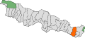
 Provinces of Nepal german 2018 Saptari.svg 1,722 × 1,021; 89 KB
-
 Saptari 1 Pratinidhi Sabha.svg 701 × 542; 279 KB
-
 Saptari 2 Pratinidhi Sabha.svg 701 × 542; 211 KB
-
 Saptari 3 Pratinidhi Sabha.svg 701 × 542; 211 KB
-
 Saptari 4 Pratinidhi Sabha.svg 701 × 542; 299 KB
-
 Saptari District .jpg 1,995 × 1,458; 189 KB
-
 Saptari District in Nepal 2015.svg 1,100 × 721; 812 KB
-
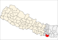 Saptari district location.png 800 × 550; 30 KB
-
 Saptari Pratinidhi Sabha.svg 747 × 578; 145 KB
-
 Saptari1PratinidhiSabha.svg 1,500 × 668; 390 KB
-
 Saptari2PratinidhiSabha.svg 1,500 × 668; 390 KB
-
 Saptari3PratinidhiSabha.svg 1,500 × 668; 390 KB
-
 Saptari4PratinidhiSabha.svg 1,500 × 668; 390 KB


