Category:Maps of Santa Cruz Department, Bolivia
Jump to navigation
Jump to search
- Departments of Bolivia
- Beni
- Chuquisaca
- Cochabamba
- La Paz
- Oruro
- Pando
- Potosí
- Santa Cruz
- Tarija
Subcategories
This category has the following 6 subcategories, out of 6 total.
Media in category "Maps of Santa Cruz Department, Bolivia"
The following 25 files are in this category, out of 25 total.
-
 Bolivia - Zona en que combatió Che Guevara.png 467 × 536; 105 KB
-
 Bolivia department of Santa Cruz.png 1,224 × 1,312; 161 KB
-
 Bolivia department of SantaCruz.png 550 × 550; 48 KB
-
 Jesuit Missions of the Chiquitos-de.png 1,500 × 906; 2.54 MB
-
 Jesuit Missions of the Chiquitos-en.png 1,500 × 906; 2.54 MB
-
 Jesuit Missions of the Chiquitos-he.png 1,500 × 906; 2.43 MB
-
 Jesuit Missions of the Chiquitos-lt.png 1,500 × 906; 2.54 MB
-
 Kaart Bolivia departement Santa Cruz.png 2,064 × 2,363; 317 KB
-
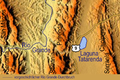
 Laguna Taborga Mapa (Bolivia).svg 1,282 × 905; 58 KB
-
 Laguna Tatarenda map.png 1,800 × 1,200; 1.78 MB
-
 Lake Huachi Bolivia.png 681 × 675; 124 KB
-
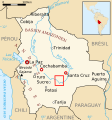
 Map of departament of Santa Cruz.png 2,385 × 2,393; 193 KB
-
 Map of santa cruz.png 2,385 × 2,393; 220 KB
-
 Numbered provinces of Santa Cruz.png 2,385 × 2,393; 209 KB
-
 Provincia de Chiquitos.svg 2,385 × 2,393; 256 KB
-
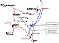
 Ruta del Che - Bolivia - 1967.png 739 × 529; 209 KB
-
 RutaDelChe 1967.svg 1,010 × 709; 52 KB
-
 RutaDelChe2.svg 1,010 × 709; 42 KB
-
 Ubicacion de Puerto Quijarro.jpg 393 × 390; 28 KB
-
 Vallegrande location.png 327 × 350; 11 KB
-
 Vallegrande.jpg 328 × 352; 30 KB
-
 Vegetation transformation in Santa Cruz, Bolivia.png 784 × 560; 1.27 MB
-
 Zona en que combatió Che Guevara-Bolivia.SVG 328 × 350; 296 KB
-
 Área metropolitana de Santa Cruz de la Sierra.png 400 × 452; 26 KB
-
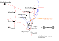
 Ñancahuazú.png 544 × 393; 70 KB


.svg)


