Category:Maps of San Vicente de la Barquera
Jump to navigation
Jump to search
Media in category "Maps of San Vicente de la Barquera"
The following 8 files are in this category, out of 8 total.
-
 Admiralty Chart No 77 Plans on the North Coast of Spain, Published 1932.jpg 11,117 × 16,215; 51.58 MB
-
 Karte Gemeinde San Vicente de la Barquera 2022.png 3,999 × 3,033; 1.25 MB
-
 MTN25-0033c3-1982-San Vicente de La Barquera.jpg 7,677 × 5,216; 6.72 MB
-
 MTN25-0033c3-1999-San Vicente de La Barquera.jpg 7,775 × 5,512; 8.87 MB
-
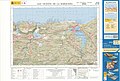 MTN25-0033c3-2017-San Vicente de la Barquera.jpg 7,579 × 5,133; 11.76 MB
-
 Royaumes d'Espagne et de Portugal 1780 Rigobert Bonne (detalle noroeste).jpg 1,318 × 1,066; 788 KB
-
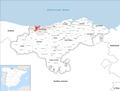
 San Vicente de la Barquera (Cantabria) Mapa.svg 675 × 425; 129 KB
-
 San Vicente de la Barquera Cantabria.png 963 × 587; 38 KB


.jpg)
_Mapa.svg)
