Category:Maps of San Mateo, California
Jump to navigation
Jump to search
Media in category "Maps of San Mateo, California"
The following 20 files are in this category, out of 20 total.
-
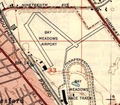
Bay Meadows Airport.tiff 507 × 442; 657 KB
-
Bay Meadows Areas of Interest.png 2,550 × 3,300; 429 KB
-
Bay Meadows Areas of Interest.svg 512 × 663; 18 KB
-
CAMap-doton-San Mateo.png 209 × 230; 4 KB
-
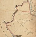
Detail from diseño Rancho San Mateo 1840s.jpg 1,168 × 1,540; 368 KB
-
Diseño of Rancho San Mateo.jpg 1,064 × 1,322; 323 KB
-
MAPOFPARKS.pdf 1,650 × 1,275; 498 KB
-
PA17-074 BayMeadows II-SPAR Map (July 2018).png 1,275 × 1,650; 1.03 MB
-
Plat of San Mateo Rancho 1857.tif 12,224 × 7,274; 284 KB
-
Race and ethnicity 2020 San Mateo, CA.png 2,400 × 2,404; 2.38 MB
-
San Mateo 1872.jpeg 2,464 × 2,016; 3.21 MB
-
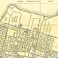
San Mateo 1914.jpeg 1,452 × 1,588; 3.64 MB
-
San Mateo 1939.jpeg 1,380 × 1,612; 3.07 MB
-
San Mateo Central Park (2015).svg 1,050 × 1,100; 12 KB
-
San Mateo County Map 1878.jpg 3,555 × 4,000; 5.16 MB
-
San Mateo Creek.jpg 1,174 × 1,200; 992 KB
-
San Mateo Map 1938 (cropped).jpg 1,135 × 1,135; 732 KB
-
San Mateo Map 1938.jpg 2,489 × 2,446; 3.07 MB
-
San Mateo, Burlingame, Hillsborough, San Carlos, Belmont Map 1938.jpg 5,100 × 3,300; 6.34 MB


