Category:Maps of Salem County, New Jersey
Jump to navigation
Jump to search
Wikimedia category | |||||
| Upload media | |||||
| Instance of | |||||
|---|---|---|---|---|---|
| Category combines topics | |||||
| Salem County | |||||
county in New Jersey, United States   | |||||
| Instance of | |||||
| Location | New Jersey | ||||
| Capital | |||||
| Inception |
| ||||
| Population |
| ||||
| Area |
| ||||
| Different from | |||||
| official website | |||||
 | |||||
Subcategories
This category has only the following subcategory.
Media in category "Maps of Salem County, New Jersey"
The following 19 files are in this category, out of 19 total.
-
 Alloway cdp nj 033.png 600 × 580; 51 KB
-
 Carneys point cdp nj 033.png 600 × 580; 49 KB
-
 Census Bureau map of Alloway Township, New Jersey.png 575 × 425; 49 KB
-
 Location map of Salem County, New Jersey.svg 896 × 768; 1.1 MB
-
 Map of New Jersey highlighting Salem County.svg 570 × 1,080; 42 KB
-
 Map of Salem County highlighting Alloway Township.png 549 × 589; 12 KB
-
 Map of Salem County highlighting Elmer Borough.png 549 × 589; 11 KB
-
 Map of Salem County highlighting Penns Grove Borough.png 549 × 589; 11 KB
-
 Map of Salem County highlighting Pittsgrove Township.png 549 × 589; 11 KB
-
 Map of Salem County highlighting Salem City.png 549 × 589; 11 KB
-
 Map of Salem County highlighting Woodstown Borough.png 549 × 589; 11 KB
-
 New Jersey Coastal Heritage Trail, Delsea region LOC 96687583.jpg 4,289 × 5,250; 3.46 MB
-
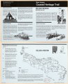 New Jersey Coastal Heritage Trail, Delsea region LOC 96687583.tif 4,289 × 5,250; 64.42 MB
-
 Olivet cdp nj 033.png 600 × 580; 50 KB
-
 Pennsville cdp nj 033.png 600 × 580; 49 KB
-

-

-
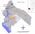
 Salem County, New Jersey Municipalities.png 660 × 580; 24 KB
-
 ZCTA 08023 Deepwater, New Jersey.gif 575 × 425; 38 KB


