Category:Maps of Sainte-Radegonde (Gers)
Jump to navigation
Jump to search
Wikimedia category | |||||
| Upload media | |||||
| Instance of | |||||
|---|---|---|---|---|---|
| Category combines topics | |||||
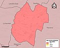
| Sainte-Radegonde | |||||
commune in Gers, France .jpg)  | |||||
| Instance of | |||||
| Location |
| ||||
| Population |
| ||||
| Area |
| ||||
| Elevation above sea level |
| ||||
| Different from | |||||
 | |||||
Media in category "Maps of Sainte-Radegonde (Gers)"
The following 5 files are in this category, out of 5 total.
-
 32405-Sainte-Radegonde-argile.jpg 3,057 × 2,480; 361 KB
-
 32405-Sainte-Radegonde-Natura2000.png 5,846 × 4,133; 3.54 MB
-
 32405-Sainte-Radegonde-Natura2000b.png 5,846 × 4,133; 3.48 MB
-
 32405-Sainte-Radegonde-ZNIEFF1.jpg 3,519 × 2,480; 463 KB
-
 32405-Sainte-Radegonde-ZNIEFF2.png 5,866 × 4,133; 3.51 MB


