Category:Maps of Sainte-Eulalie-de-Cernon
Jump to navigation
Jump to search
Wikimedia category | |||||
| Upload media | |||||
| Instance of | |||||
|---|---|---|---|---|---|
| Category combines topics | |||||
| Sainte-Eulalie-de-Cernon | |||||
commune in Aveyron, France  .svg)  | |||||
| Instance of | |||||
| Location |
| ||||
| Population |
| ||||
| Area |
| ||||
| Elevation above sea level |
| ||||
| official website | |||||
 | |||||
Media in category "Maps of Sainte-Eulalie-de-Cernon"
The following 12 files are in this category, out of 12 total.
-
 12220-Sainte-Eulalie-de-Cernon-Arron.png 3,057 × 2,480; 1.23 MB
-
 12220-Sainte-Eulalie-de-Cernon-cadastre.svg 961 × 744; 4.34 MB
-
 12220-Sainte-Eulalie-de-Cernon-Canton.png 3,057 × 2,480; 1.24 MB
-
 12220-Sainte-Eulalie-de-Cernon-EPCI.png 3,057 × 2,480; 1.25 MB
-
 12220-Sainte-Eulalie-de-Cernon-Hydro.png 3,519 × 2,480; 1.44 MB
-
 12220-Sainte-Eulalie-de-Cernon-Natura2000.png 7,039 × 4,960; 3.22 MB
-
 12220-Sainte-Eulalie-de-Cernon-Sols.png 3,507 × 2,480; 1.93 MB
-
 12220-Sainte-Eulalie-de-Cernon-ZNIEFF1.png 3,519 × 2,480; 1.55 MB
-
 12220-Sainte-Eulalie-de-Cernon-ZNIEFF2.png 3,519 × 2,480; 1.33 MB
-
 12220-Sainte-Eulalie-de-Cernon-Zone inondable.svg 1,070 × 744; 2.13 MB
-
 Map commune FR insee code 12220.png 756 × 605; 85 KB
-
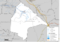
 Ste-Eulalie-de-Cernon carte.jpg 331 × 357; 12 KB


