Category:Maps of Sainte-Croix-de-Quintillargues
Jump to navigation
Jump to search
Wikimedia category | |||||
| Upload media | |||||
| Instance of | |||||
|---|---|---|---|---|---|
| Category combines topics | |||||
| Sainte-Croix-de-Quintillargues | |||||
commune in Hérault, France    | |||||
| Instance of | |||||
| Location | |||||
| Population |
| ||||
| Area |
| ||||
| Elevation above sea level |
| ||||
| official website | |||||
 | |||||
Media in category "Maps of Sainte-Croix-de-Quintillargues"
The following 10 files are in this category, out of 10 total.
-
 34248-Sainte-Croix-de-Quintillargues-argile.jpg 3,057 × 2,480; 482 KB
-
 34248-Sainte-Croix-de-Quintillargues-Natura2000b.png 7,015 × 4,960; 5.59 MB
-
 34248-Sainte-Croix-de-Quintillargues-Routes-Hydro.png 3,507 × 2,480; 1.36 MB
-
 34248-Sainte-Croix-de-Quintillargues-Sols.png 3,270 × 2,598; 1.19 MB
-
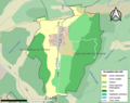
 34248-Sainte-Croix-de-Quintillargues-ZNIEFF1.png 3,519 × 2,480; 3.69 MB
-
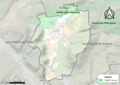
 34248-Sainte-Croix-de-Quintillargues-ZNIEFF2.png 3,519 × 2,480; 3.26 MB
-
 Map commune FR insee code 34248.png 756 × 605; 40 KB
-
 Sainte-Croix-de-Quintillargues OSM 01.png 452 × 545; 219 KB
-
 Sainte-Croix-de-Quintillargues OSM 02.png 452 × 545; 479 KB
-
 Sainte-Croix-de-Quintillargues OSM 03.png 520 × 545; 316 KB


