Category:Maps of Saint-Pierre-de-Soucy
Jump to navigation
Jump to search
Wikimedia category | |||||
| Upload media | |||||
| Instance of | |||||
|---|---|---|---|---|---|
| Category combines topics | |||||
| Saint-Pierre-de-Soucy | |||||
commune in Savoie, France .JPG) .JPG)  | |||||
| Instance of | |||||
| Location |
| ||||
| Population |
| ||||
| Area |
| ||||
| Elevation above sea level |
| ||||
 | |||||
Subcategories
This category has only the following subcategory.
Media in category "Maps of Saint-Pierre-de-Soucy"
The following 10 files are in this category, out of 10 total.
-
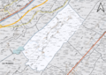
 73276-Saint-Pierre-de-Soucy - Localisation.png 3,507 × 2,480; 1.1 MB
-
 73276-Saint-Pierre-de-Soucy-Cadastre.png 7,015 × 4,960; 11.36 MB
-
 73276-Saint-Pierre-de-Soucy-Hydro.jpeg 5,846 × 4,133; 2.32 MB
-
 73276-Saint-Pierre-de-Soucy-Hydro.png 7,015 × 4,960; 6.37 MB
-
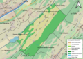
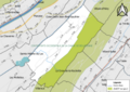
 73276-Saint-Pierre-de-Soucy-Natura 2000.png 7,015 × 4,960; 5.19 MB
-
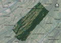 73276-Saint-Pierre-de-Soucy-Orthophoto.png 7,015 × 4,960; 9.97 MB
-
 73276-Saint-Pierre-de-Soucy-Sols.png 7,015 × 4,960; 7 MB
-
 73276-Saint-Pierre-de-Soucy-ZNIEFF1.png 7,015 × 4,960; 5.18 MB
-
 73276-Saint-Pierre-de-Soucy-ZNIEFF2.png 7,015 × 4,960; 5.21 MB
-
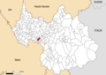
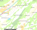 Map commune FR insee code 73276.png 756 × 605; 66 KB


