Category:Maps of Saint-Léger-de-Montbrun
Jump to navigation
Jump to search
Wikimedia category | |||||
| Upload media | |||||
| Instance of | |||||
|---|---|---|---|---|---|
| Category combines topics | |||||
| Saint-Léger-de-Montbrun | |||||
commune in Deux-Sèvres, France  .svg)  | |||||
| Instance of | |||||
| Location |
| ||||
| Population |
| ||||
| Area |
| ||||
| Elevation above sea level |
| ||||
 | |||||
Media in category "Maps of Saint-Léger-de-Montbrun"
The following 6 files are in this category, out of 6 total.
-
 79265-Saint-Léger-de-Montbrun-argile.jpg 3,057 × 2,480; 632 KB
-
 79265-Saint-Léger-de-Montbrun-Hydro.png 3,507 × 2,480; 4.71 MB
-
 79265-Saint-Léger-de-Montbrun-Sols.png 3,270 × 2,598; 3.01 MB
-
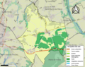
 79265-Saint-Léger-de-Montbrun-ZNIEFF1.png 5,866 × 4,133; 8.26 MB
-
 79265-Saint-Léger-de-Montbrun-ZNIEFF2.png 5,866 × 4,133; 8.25 MB
-
 Map commune FR insee code 79265.png 756 × 605; 73 KB


