Category:Maps of Saint-Hilaire (Essonne)
Jump to navigation
Jump to search
Wikimedia category | |||||
| Upload media | |||||
| Instance of | |||||
|---|---|---|---|---|---|
| Category combines topics | |||||
| Saint-Hilaire | |||||
commune in Essonne, France   | |||||
| Instance of | |||||
| Location |
| ||||
| Head of government |
| ||||
| Population |
| ||||
| Area |
| ||||
| Elevation above sea level |
| ||||
| Different from | |||||
| official website | |||||
 | |||||
Media in category "Maps of Saint-Hilaire (Essonne)"
The following 12 files are in this category, out of 12 total.
-
 91 Communes Essonne Saint-Hilaire.png 723 × 750; 166 KB
-
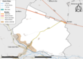
 91556-Saint-Hilaire - Localisation.png 2,500 × 2,480; 1,016 KB
-
 91556-Saint-Hilaire-cadastre.png 7,015 × 4,960; 4.88 MB
-
 91556-Saint-Hilaire-géologie.png 7,015 × 4,960; 3.19 MB
-
 91556-Saint-Hilaire-Hydro.jpeg 5,846 × 4,133; 1.27 MB
-
 91556-Saint-Hilaire-Hydro.png 7,015 × 4,960; 2.69 MB
-
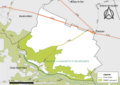
 91556-Saint-Hilaire-Natura 2000.png 7,015 × 4,960; 2.27 MB
-
 91556-Saint-Hilaire-Orthophoto.png 7,015 × 4,960; 3.79 MB
-
 91556-Saint-Hilaire-sols.png 7,015 × 4,960; 3.15 MB
-
 91556-Saint-Hilaire-ZNIEFF1.png 7,015 × 4,960; 2.42 MB
-
 91556-Saint-Hilaire-ZNIEFF2.png 7,015 × 4,960; 2.9 MB
-
 Map commune FR insee code 91556.png 756 × 605; 25 KB


