Category:Maps of Saint-Cyr-sur-Menthon by Chabe01
Jump to navigation
Jump to search
Media in category "Maps of Saint-Cyr-sur-Menthon by Chabe01"
The following 41 files are in this category, out of 41 total.
-
 Axes Ferroviaires Alentours Saint-Cyr-sur-Menthon 2020.svg 966 × 628; 233 KB
-
 Axes Routiers Alentours Saint-Cyr-sur-Menthon.svg 1,031 × 750; 147 KB
-
 Axes routiers Mâcon (St Cyr).svg 800 × 800; 64 KB
-
 Axes routiers St Cyr s-Menthon.svg 850 × 780; 92 KB
-
 Carte géologique Brute St Cyr Menthon.svg 850 × 850; 272 KB
-
 Carte géologique St Cyr Menthon.svg 850 × 850; 308 KB
-
 Carte Hameau Les Gambys (2020) - Saint-Cyr-sur-Menthon.svg 648 × 672; 438 KB
-
 Carte Lieux-Dits Saint-Cyr-sur-Menthon 1941.svg 1,263 × 700; 249 KB
-
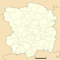
 Carte Localisation Saint-Cyr-sur-Menthon Administratif.svg 640 × 640; 167 KB
-
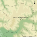
 Carte Localisation Saint-Cyr-sur-Menthon Relief.svg 640 × 640; 295 KB
-
-
 Carte PLU Simplifiée 2016 Saint-Cyr-sur-Menthon Avec Nom.svg 1,500 × 1,500; 160 KB
-
 Carte PLU Simplifiée 2016 Saint-Cyr-sur-Menthon.svg 1,500 × 1,500; 132 KB
-
 Carte topographique Brute St Cyr Menthon.svg 640 × 640; 202 KB
-
 Carte topographique St Cyr Menthon.svg 640 × 640; 205 KB
-
 Centre St Cyr Menthon 2017.svg 1,200 × 1,070; 203 KB
-
 Centre St Cyr Menthon 2020.svg 1,200 × 1,100; 204 KB
-

-
 Localisation Dépendance Ferme Planons St Cyr Menthon.svg 1,000 × 1,000; 3 KB
-
 Localisation Maison Habitation Ferme Planons St Cyr Menthon.svg 1,000 × 1,000; 3 KB
-
 Localisation Puits Ferme Planons St Cyr Menthon.svg 1,000 × 1,000; 3 KB
-
 Plan Domaine Planons St Cyr Menthon.svg 1,000 × 1,000; 64 KB
-
 Profil fossé Bresse St Cyr Menthon.svg 815 × 450; 150 KB
-
 Projet Rives Menthon 2016 St Cyr Menthon.svg 800 × 640; 170 KB
-
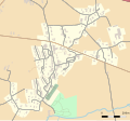
 St Cyr Menthon - Bâtiments (Août 2017).svg 610 × 610; 516 KB
-
 St Cyr Menthon - Géolocalisation.svg 1,531 × 1,485; 4.39 MB
-
 St Cyr Menthon - Lieux-dits.svg 920 × 920; 136 KB
-
 St Cyr Menthon - Plan.svg 1,633 × 1,584; 709 KB
-
 St Cyr Menthon - Routes.svg 1,531 × 1,485; 490 KB
-
 St Cyr Menthon - Territoire.svg 1,531 × 1,485; 1.95 MB
-
 St Cyr Menthon Eau.svg 1,531 × 1,485; 563 KB
-
 St-Cyr - Ain - PdV.svg 984 × 984; 211 KB
-
 St-Cyr - Ain - Vonnas.svg 801 × 728; 2.38 MB
-
 St-Cyr - Ain.svg 984 × 902; 204 KB
-
 St-Cyr-sur-Menthon.svg 984 × 643; 7 KB
-
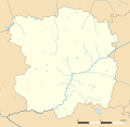
 Territoire St Cyr sur Menthon.svg 850 × 780; 211 KB
-
 Village St Cyr Projet Rives Menthon 2016 Phase 0.svg 775 × 720; 327 KB
-
 Village St Cyr Projet Rives Menthon 2016 Phase 1.svg 775 × 720; 334 KB
-
 Village St Cyr Projet Rives Menthon 2016 Phase 2.svg 775 × 720; 341 KB
-
 Village St Cyr Projet Rives Menthon 2016 Phase 3.svg 775 × 720; 349 KB
-
 Village St Cyr Projet Rives Menthon 2016 Phase 4.svg 775 × 720; 309 KB


.svg)


_-_Saint-Cyr-sur-Menthon.svg)


.svg)


