Category:Maps of Saint-Caprais (Cher)
Jump to navigation
Jump to search
Wikimedia category | |||||
| Upload media | |||||
| Instance of | |||||
|---|---|---|---|---|---|
| Category combines topics | |||||
| Saint-Caprais | |||||
commune in Cher, France .jpg)  | |||||
| Instance of | |||||
| Named after | |||||
| Location |
| ||||
| Located in or next to body of water | |||||
| Population |
| ||||
| Area |
| ||||
| Elevation above sea level |
| ||||
| Different from | |||||
 | |||||
Media in category "Maps of Saint-Caprais (Cher)"
The following 4 files are in this category, out of 4 total.
-
 18201-Saint-Caprais-argile.png 3,057 × 2,480; 2.29 MB
-
 18201-Saint-Caprais-Hydro.jpeg 5,846 × 4,133; 1.48 MB
-
 18201-Saint-Caprais-Sols.png 3,270 × 2,598; 1.76 MB
-
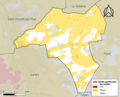
 Map commune FR insee code 18201.png 756 × 605; 45 KB


