Category:Maps of Safed
Jump to navigation
Jump to search
Subcategories
This category has only the following subcategory.
S
Media in category "Maps of Safed"
The following 15 files are in this category, out of 15 total.
-
19-26-Safad-1942 (Edh Dhahiriya et Tahta).jpg 1,455 × 880; 436 KB
-
19-26-Safad-1942 (Edh Dhahriya et Tahta land area).jpg 1,823 × 2,610; 1.57 MB
-
Biriya1954.png 2,231 × 2,373; 3.66 MB
-
Jaauneh - Rosh Pina - PEF map 1880.jpg 1,545 × 667; 346 KB
-
Jamnith = Kh. Banit.jpg 1,362 × 627; 1.14 MB
-
Map of Safed cs.png 300 × 200; 74 KB
-
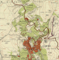
Northern suburbs of Safed Survey of Palestine map from 1942.png 745 × 757; 1.22 MB
-
Panorama des heiligen Landes (FL44263171 2369614) (cropped2).jpg 2,960 × 1,482; 8.28 MB
-
Safad area.jpg 495 × 263; 90 KB
-
Safed 2020 street map overlaid on Survey of Palestine map from 1942.png 1,090 × 785; 1.9 MB
-
Safed old city.svg 1,118 × 1,221; 3.36 MB
-
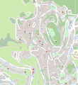
Safed osm.svg 721 × 631; 582 KB
-
Safed Survey of Palestine map from 1942.png 1,090 × 786; 1.82 MB
-
Safed-location.png 100 × 301; 3 KB


