
Category:Maps of Súdwest-Fryslân
Wikimedia category | |||||
| Upload media | |||||
| Instance of | |||||
|---|---|---|---|---|---|
| Category combines topics | |||||
| Súdwest-Fryslân | |||||
Dutch municipality in Friesland       | |||||
| Instance of |
| ||||
| Location | Friesland, Netherlands | ||||
| Located in or next to body of water | |||||
| Capital | |||||
| Head of government |
| ||||
| Inception |
| ||||
| Population |
| ||||
| Area |
| ||||
| Elevation above sea level |
| ||||
| official website | |||||
 | |||||
Subcategories
This category has the following 13 subcategories, out of 13 total.
Media in category "Maps of Súdwest-Fryslân"
The following 20 files are in this category, out of 20 total.
-
 2013-SudwestFryslan.jpg 6,589 × 6,161; 15.31 MB
-
 BAG woonplaatsen - Gemeente Súdwest-Fryslân.png 2,419 × 2,419; 1.12 MB
-
 Gem-SudwestFryslan-2014Q1.jpg 12,847 × 12,363; 40.11 MB
-
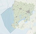 Gem-SudwestFryslan-OpenTopo.jpg 14,027 × 13,375; 13.81 MB
-
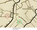 Harinxma.jpg 625 × 523; 47 KB
-

-
 Makkum omgeving OSM.png 695 × 687; 223 KB
-
 Makkumerwaarden OSM.png 393 × 685; 128 KB
-
 Map - NL - Municipality code 1900 (2014).png 2,000 × 1,067; 145 KB
-
 Map - NL - Municipality code 1900 (2019).svg 300 × 160; 444 KB
-
 Nationaal Landschap Zuidwest Fryslan kaart.jpg 469 × 448; 118 KB
-
 Oudegaasterbrekken.png 819 × 495; 123 KB
-
 Regels Barradeel zuid Wonsdl.png 1,346 × 1,110; 3.71 MB
-
 Rijksbeschermd stads- of dorpsgezicht - Cornwerd.png 2,016 × 2,267; 42 KB
-
 Rijksbeschermd stads- of dorpsgezicht - Kornwerderzand.png 2,016 × 2,267; 126 KB
-
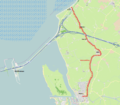
 Stoomtrein Sneek - Stavoren.png 823 × 700; 572 KB
-
 Súdwest-Fryslân locator map municipality NL 2018.png 760 × 598; 99 KB
-
 LocatieWitmarsum.png 280 × 130; 9 KB
-
 Wonsstelling.png 1,704 × 1,498; 1.05 MB
-
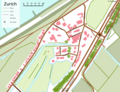 Zurich Friesland map.png 1,764 × 1,350; 196 KB


.png)
.svg)


