Category:Maps of Sénergues
Jump to navigation
Jump to search
Wikimedia category | |||||
| Upload media | |||||
| Instance of | |||||
|---|---|---|---|---|---|
| Category combines topics | |||||
| Sénergues | |||||
commune in Aveyron, France   | |||||
| Instance of | |||||
| Location |
| ||||
| Located in or next to body of water | |||||
| Population |
| ||||
| Area |
| ||||
| Elevation above sea level |
| ||||
| official website | |||||
 | |||||
Media in category "Maps of Sénergues"
The following 14 files are in this category, out of 14 total.
-
 12268-Sénergues-Arron.png 3,057 × 2,480; 1.25 MB
-
 12268-Sénergues-cadastre.svg 961 × 744; 6.96 MB
-
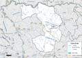
 12268-Sénergues-Canton.png 3,057 × 2,480; 1.25 MB
-
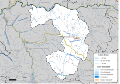
 12268-Sénergues-EPCI.png 3,057 × 2,480; 1.26 MB
-
 12268-Sénergues-Hydro.png 3,519 × 2,480; 3.05 MB
-
 12268-Sénergues-Natura2000.png 7,039 × 4,960; 6.46 MB
-
 12268-Sénergues-Sols.png 3,507 × 2,480; 3.57 MB
-
 12268-Sénergues-ZNIEFF1.png 3,519 × 2,480; 2.77 MB
-
 12268-Sénergues-ZNIEFF2.png 3,519 × 2,480; 2.66 MB
-
 12268-Sénergues-Zone inondable.svg 1,070 × 744; 4.74 MB
-
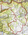
 Map commune FR insee code 12268.png 756 × 605; 70 KB
-
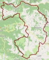 Sénergues OSM 01.png 333 × 412; 164 KB
-
 Sénergues OSM 02.png 333 × 412; 332 KB
-
 Sénergues OSM 03.png 667 × 586; 485 KB


