Category:Maps of Rue (Somme)
Jump to navigation
Jump to search
Wikimedia category | |||||
| Upload media | |||||
| Instance of | |||||
|---|---|---|---|---|---|
| Category combines topics | |||||
| Rue | |||||
commune in Somme, France    | |||||
| Instance of | |||||
| Location |
| ||||
| Population |
| ||||
| Area |
| ||||
| Different from | |||||
| official website | |||||
 | |||||
Media in category "Maps of Rue (Somme)"
The following 11 files are in this category, out of 11 total.
-
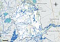 80688-Rue-Hydro.jpeg 5,846 × 4,133; 2.58 MB
-
 80688-Rue-Sols.png 3,270 × 2,598; 2.37 MB
-
 Cnt de Rue.png 800 × 600; 45 KB
-
 Fortifications Rue 1656 Zeiller 14379.jpg 4,008 × 2,432; 4.56 MB
-
 Fotothek df tg 0001870 Architektur ^ Festungsbau.jpg 800 × 509; 179 KB
-
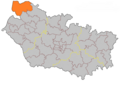
 Map commune FR insee code 80688.png 756 × 605; 69 KB
-
 Plan de rue - btv1b53010935d.jpg 8,434 × 5,452; 4.51 MB
-
 Périmètre RNR Bois des Agneux rnr311.png 598 × 738; 249 KB
-
 Rue (Somme) Limite communale.jpg 974 × 576; 138 KB
-
 Rue 1634 Tassin 15882.jpg 3,158 × 2,205; 6.54 MB
-
 Rue 1634 Tassin 15883.jpg 3,449 × 2,425; 8.64 MB


_Limite_communale.jpg)

