Category:Maps of Rosario (Argentina)
Jump to navigation
Jump to search
Wikimedia category | |||||
| Upload media | |||||
| Instance of | |||||
|---|---|---|---|---|---|
| Category combines topics | |||||
| Rosario | |||||
city in Argentina     | |||||
| Spoken text audio | |||||
| Instance of |
| ||||
| Part of | |||||
| Location | Rosario Department, Santa Fe Province, Argentina | ||||
| Located in or next to body of water | |||||
| Legislative body |
| ||||
| Executive body |
| ||||
| Head of government |
| ||||
| Inception |
| ||||
| Population |
| ||||
| Area |
| ||||
| Elevation above sea level |
| ||||
| official website | |||||
 | |||||
Subcategories
This category has only the following subcategory.
Media in category "Maps of Rosario (Argentina)"
The following 21 files are in this category, out of 21 total.
-
 Barrio Tiro Suizo.jpg 552 × 490; 87 KB
-
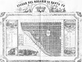 Ciudad del Rosario de Santa Fe (1858).jpg 3,296 × 2,502; 1.52 MB
-
 Districts of Rosario (blank).svg 765 × 990; 7 KB
-
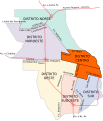
 Districts of Rosario (noted) (en).svg 765 × 990; 19 KB
-
 Distrito Centro - Rosario.svg 383 × 446; 34 KB
-
 Distrito Sur - Rosario.svg 383 × 446; 34 KB
-
 Distritos de Rosario.svg 400 × 415; 67 KB
-
 España Park Rosario.jpg 1,332 × 1,198; 516 KB
-
 Gran Rosario.png 477 × 492; 62 KB
-
 Gran Rosario.svg 905 × 1,116; 979 KB
-
 ISD highres ISS001 ISS001-390-4.JPG 2,988 × 1,987; 2.12 MB
-
 Lage Rosario.gif 442 × 769; 13 KB
-
 Mapa de Rosario mostrando sus accesos.png 2,000 × 2,000; 786 KB
-
 Mapa de Rosario, Argentina, 1909.png 4,145 × 5,307; 34.14 MB
-
 Mapa de Rosario, Argentina.svg 800 × 500; 250 KB
-
 Mapas Digitales.JPG 640 × 361; 82 KB
-
 Parque de la Independencia.svg 1,024 × 1,114; 24 KB
-
 Rosario gas explosion - location map.png 668 × 508; 123 KB
-
 Rosario mapa.svg 3,300 × 3,300; 968 KB
-
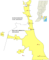
 Rosario, Argentina - Situation map.png 390 × 251; 54 KB
-
 Urquiza Park (Rosario).jpg 1,069 × 1,264; 361 KB

.jpg)
_(en).svg)


.jpg)
.svg)