Category:Maps of Roosevelt, Utah
Jump to navigation
Jump to search
| NO WIKIDATA ID FOUND! Search for Maps of Roosevelt, Utah on Wikidata | |
| Upload media |
Subcategories
This category has only the following subcategory.
Media in category "Maps of Roosevelt, Utah"
The following 5 files are in this category, out of 5 total.
-
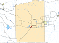 CtyMapDuchesne.png 936 × 689; 49 KB
-
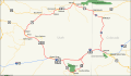 DinosaurDiamond map.svg 1,475 × 860; 769 KB
-
 Duchesne County Utah incorporated and unincorporated areas Roosevelt highlighted.svg 1,070 × 741; 9.82 MB
-
 Uintahcounty ut.png 616 × 1,099; 46 KB
-
 UTMap-doton-Roosevelt.PNG 238 × 300; 18 KB


