Category:Maps of Richmond, Virginia
Appearance
- 100 most populous cities of the United States
- 1–25
- Austin
- Boston
- Charlotte
- Chicago
- Columbus
- Dallas
- Denver
- El Paso
- Fort Worth
- Houston
- Indianapolis
- Jacksonville
- Los Angeles
- Nashville
- New York City
- Oklahoma City
- Philadelphia
- Phoenix
- Portland
- San Antonio
- San Diego
- San Francisco
- San Jose
- Seattle
- Washington, D.C.
- 26–50
- Arlington
- Atlanta
- Bakersfield
- Colorado Springs
- Detroit
- Fresno
- Kansas City
- Las Vegas
- Long Beach
- Louisville
- Memphis
- Miami
- Minneapolis
- Oakland
- Omaha
- Raleigh
- Sacramento
- Tucson
- Tulsa
- Virginia Beach
- Wichita
- 51–75
- Anaheim
- Anchorage
- Cincinnati
- Cleveland
- Corpus Christi
- Durham
- Greensboro
- Henderson
- Honolulu
- Irvine
- Jersey City
- Lexington
- Lincoln
- Newark
- New Orleans
- Orlando
- Pittsburgh
- Plano
- Saint Paul
- Santa Ana
- St. Louis
- Tampa
- 76–100
- Boise
- Buffalo
- Chesapeake
- Chula Vista
- Fort Wayne
- Laredo
- Lubbock
- Madison
- Norfolk
- Richmond
- Santa Clarita
- Scottsdale
- St. Petersburg
- Spokane
- Toledo
- Winston-Salem
Wikimedia category | |||||
| Upload media | |||||
| Instance of | |||||
|---|---|---|---|---|---|
| Category combines topics | |||||
| Richmond | |||||
capital city of Virginia, United States of America | |||||
| Instance of | |||||
| Named after | |||||
| Location | Virginia | ||||
| Head of government |
| ||||
| Inception |
| ||||
| Population |
| ||||
| Area |
| ||||
| Elevation above sea level |
| ||||
| Different from | |||||
| official website | |||||
 | |||||
Subcategories
This category has the following 4 subcategories, out of 4 total.
Media in category "Maps of Richmond, Virginia"
The following 96 files are in this category, out of 96 total.
-
"Richmond and its Defenses.".jpg 4,027 × 5,940; 7.8 MB
-
01 Atlas of Richmond, Virginia, and vicinity (16601934999).jpg 1,223 × 1,558; 452 KB
-
02 (Inside front cover) (16580774357).jpg 2,379 × 2,500; 435 KB
-
05 Outline and index map Richmond and vicinity (16786976542).jpg 2,333 × 1,581; 935 KB
-
06 Part of Madison and Monroe Wards Richmond (16601908389).jpg 2,395 × 1,609; 762 KB
-
07 Part of Jefferson Ward Richmond (16600702390).jpg 2,331 × 1,574; 770 KB
-
08 Part of Jefferson and Marshall Wards Richmond (16762204726).jpg 2,327 × 1,575; 794 KB
-
09 Part of Jackson and Jefferson Wards Richmond (16600696720).jpg 2,340 × 1,579; 723 KB
-
10 Part of Madison and Monroe Wards Richmond (16786931671).jpg 2,334 × 1,587; 742 KB
-
11 Parts Clay and Monroe Wards Richmond (16601931579).jpg 2,281 × 1,560; 731 KB
-
12 Part of Monroe and Clay Wards Richmond (16600688140).jpg 2,357 × 1,588; 877 KB
-
14 Part of Clay Ward Richmond and Upper District Henrico Co. (16600676170).jpg 2,301 × 1,577; 746 KB
-
15 Part of Clay Ward Richmond Upper District Henrico Co. (16786924621).jpg 2,348 × 1,602; 734 KB
-
16 Vicinity of Richmond part of Upper District Henrico Co. (16762181646).jpg 2,320 × 1,581; 561 KB
-
17 Vicinity of Richmond part of Upper District Henrico Co. (16786974732).jpg 2,349 × 1,588; 597 KB
-
18 Part of Clay Ward Richmond and Upper District Henrico Co. (16786927961).jpg 2,367 × 1,608; 728 KB
-
1897 Poor's Richmond Railway and Electric Company.jpg 4,126 × 2,618; 2.34 MB
-
22 Part of Marshall Ward Richmond and Lower District Henrico Co. (16601911699).jpg 2,328 × 1,613; 479 KB
-
23 Part of Marshall Ward Richmond and Lower District Henrico Co. (16786917031).jpg 2,339 × 1,594; 829 KB
-
24 Vicinity of Richmond part of Manchester and Chesterfield Co. (16786942441).jpg 1,195 × 1,587; 368 KB
-
27 (Back cover) (16786954222).jpg 1,236 × 1,562; 399 KB
-
357 of 'The Youth's History of the United States, etc' (11188181953).jpg 2,056 × 1,820; 660 KB
-
Birds eye view of Richmond and the vicinity (17181770129).jpg 3,000 × 2,332; 2.07 MB
-
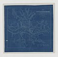
Blueprint Map of the Vicinity of Richmond - NARA - 70653212 (page 1).jpg 8,940 × 11,225; 9.09 MB
-
Blueprint Map of the Vicinity of Richmond - NARA - 70653212 (page 2).jpg 8,771 × 7,172; 3.8 MB
-
Britannica Totopotomoy and Cold Harbor.jpg 866 × 860; 224 KB
-
Chimborazo hospital richmond civil war Map Detail.png 924 × 693; 658 KB
-
Chimborazo hospital richmond civil war position.png 750 × 844; 521 KB
-
Chimborazo Park.svg 800 × 522; 203 KB
-
City of Richmond, Virginia and Environs - NARA - 85713737 (page 1).jpg 9,832 × 7,841; 16.03 MB
-
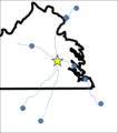
DistancesToRichmond.png 757 × 448; 10 KB
-
DistancesToRichmond2 notext3.png 847 × 957; 48 KB
-
DistancesToRichmond2.png 845 × 955; 42 KB
-
DistancesToRichmond3.png 813 × 913; 151 KB
-
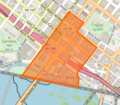
DowntownRichmondNeighborhoods.jpg 659 × 564; 104 KB
-
Gloucester Point Fort, Richmond, 20 September 1861. LOC 2005625005.jpg 2,468 × 3,166; 749 KB
-
Gloucester Point Fort, Richmond, 20 September 1861. LOC 2005625005.tif 2,468 × 3,166; 22.36 MB
-
Johnson's map of the vicinity of Richmond, and Peninsula Campaign. Johnson 1862.jpg 2,005 × 1,345; 243 KB
-
La Prade Map 1888 of Chesterfield County (zoom on Manchester to Drewrys Bluff).jpg 1,059 × 1,760; 330 KB
-
Map of a part of the city of Richmond showing the burnt districts LOC 99448330.jpg 3,814 × 2,526; 1.39 MB
-
Map of Richmond 1864 small.jpg 3,219 × 2,938; 3.69 MB
-
Map of Richmond 1864 with burnt districts small.jpg 3,219 × 2,938; 3.69 MB
-
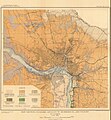
Map of richmond from 1911 USGS economic geology report.pdf 1,914 × 2,000; 1.31 MB
-
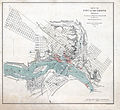
Map of Richmond, Ellyson, 1856.jpg 2,100 × 1,666; 1.26 MB
-
Map of Richmond, Virginia, and its environs, showing the Rebel forts, etc. (16811004913).jpg 2,343 × 3,000; 1.33 MB
-
Map of the Central Office District in Richmond, Virginia.png 629 × 549; 503 KB
-
Map of the City of Richmond Showing Its Defenses - NARA - 70653198 (page 1).jpg 4,478 × 4,388; 1.87 MB
-
Map of the City of Richmond Showing Its Defenses - NARA - 70653198 (page 2).jpg 4,005 × 4,312; 1.4 MB
-
Map of the neighbourhood of Richmond and Petersburg, Virginia.jpg 1,316 × 1,963; 581 KB
-
Map of the Vicinity of Richmond - NARA - 70653196.jpg 8,089 × 9,903; 8.96 MB
-
Map of the Vicinity of Richmond and Part of the Peninsula - NARA - 70653204 (page 1).jpg 13,364 × 12,534; 13.47 MB
-
Map of the Vicinity of Richmond and Part of the Peninsula - NARA - 70653204 (page 2).jpg 12,930 × 12,032; 10.76 MB
-
Map of the vicinity of Richmond, Va. and part of the Peninsula LOC lva0000169.jpg 8,358 × 5,120; 7.61 MB
-
Map showing Richmond city, Virginia.png 750 × 485; 34 KB
-
Personal Memoirs of Ulysses S. Grant Volume II (page 313 crop).jpg 2,256 × 1,366; 1.24 MB
-
Race and ethnicity 2010- Richmond (5560433168).png 3,009 × 3,009; 3.13 MB
-
Richmond City 1911 01.jpg 1,873 × 2,031; 1.56 MB
-
Richmond metro area.png 1,390 × 1,390; 1.41 MB
-
Richmond Metropolitan Area.png 638 × 293; 33 KB
-
Richmond Virginia US street map.svg 3,072 × 2,514; 9.46 MB
-
Richmond, Virginia 1955 Yellow Book.jpg 800 × 1,120; 214 KB
-
Richmond-map-Adams.jpg 700 × 633; 127 KB
-
Richmond-map.jpg 1,654 × 1,165; 313 KB
-
Richmond-Petersburg Map from Virginia Power Passenger & Power Co.jpg 9,541 × 3,512; 8.86 MB
-
Richmond-Petersburg TIGER MAP.gif 422 × 359; 18 KB
-
RichmondFanDistrict.jpg 664 × 561; 114 KB
-
RichmondFanDistrictBoundaries.jpg 659 × 561; 108 KB
-
RichmondNSEW.png 684 × 566; 403 KB
-
Sherwood Park Civic Association.jpg 5,100 × 3,300; 2.31 MB
-
Sherwood Park Civic Association.png 5,100 × 3,300; 3.22 MB
-
Sherwood Park Olmsted Final Plan.jpg 6,087 × 4,881; 7.22 MB
-
Stonewall Jackson and the American Civil War (1909) (14759566501).jpg 1,738 × 2,126; 1.02 MB
-
The Commercial and financial chronicle (1911) (14595451960).jpg 4,320 × 2,646; 2.34 MB
-
USGS map of Richmond, Virginia in 1934 (crop showing Broad Street Station).jpg 2,465 × 2,202; 699 KB
-
VAMap-doton-Richmond.PNG 595 × 262; 10 KB
-
Virginia Senate District 10 (2011).png 3,505 × 1,532; 685 KB
-
Virginia Senate District 16 (2011).png 3,507 × 1,526; 684 KB
-
Virginia Senate District 9 (2011).png 3,507 × 1,527; 686 KB
-
Wikivoyage Richmond Map PNG.png 617 × 540; 64 KB
-
Wikivoyage Richmond Map.svg 744 × 1,052; 427 KB

