Category:Maps of Reugny (Indre-et-Loire)
Jump to navigation
Jump to search
Wikimedia category | |||||
| Upload media | |||||
| Instance of | |||||
|---|---|---|---|---|---|
| Category combines topics | |||||
| Reugny | |||||
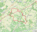
commune in Indre-et-Loire, France  .svg) _OSM_03.png) | |||||
| Pronunciation audio | |||||
| Instance of | |||||
| Location |
| ||||
| Street address |
| ||||
| Population |
| ||||
| Area |
| ||||
| Different from | |||||
| official website | |||||
 | |||||
Media in category "Maps of Reugny (Indre-et-Loire)"
The following 8 files are in this category, out of 8 total.
-
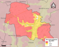 37194-Reugny-argile.png 3,057 × 2,480; 3 MB
-
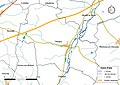 37194-Reugny-Cours eau.jpg 3,507 × 2,480; 561 KB
-
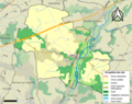 37194-Reugny-Sols.png 3,270 × 2,598; 2.36 MB
-
 Carte de Cassini de Reugny.jpg 700 × 502; 173 KB
-
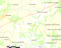 Map commune FR insee code 37194.png 756 × 605; 62 KB
-
 Reugny (Indre-et-Loire) OSM 01.png 660 × 573; 373 KB
-
 Reugny (Indre-et-Loire) OSM 02.png 660 × 573; 541 KB
-
 Reugny (Indre-et-Loire) OSM 03.png 660 × 573; 487 KB


_OSM_01.png)
_OSM_02.png)