Category:Maps of Rees
Jump to navigation
Jump to search
Wikimedia category | |||||
| Upload media | |||||
| Instance of | |||||
|---|---|---|---|---|---|
| Category combines topics | |||||
| Rees | |||||
town in Kleve District, in North Rhine-Westphalia, Germany | |||||
| Instance of |
| ||||
| Location |
| ||||
| Head of government |
| ||||
| Significant event |
| ||||
| Population |
| ||||
| Area |
| ||||
| Elevation above sea level |
| ||||
| official website | |||||
 | |||||
Kreis Kleve  Bedburg-Hau · Emmerich am Rhein · Geldern · Goch · Kalkar · Kevelaer · Kleve · Rees · Uedem · Wachtendonk · Weeze ·
Media in category "Maps of Rees"
The following 20 files are in this category, out of 20 total.
-
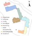
Aspel Grundriss.png 998 × 1,140; 124 KB
-
Haus Aspel Klevisches Kataster 1734.jpg 1,325 × 2,004; 755 KB
-
Haus Empel Katasterkarte 1733.jpg 835 × 782; 228 KB
-
Karte Amt Haldern.svg 929 × 894; 17 KB
-
Karte Amt Rees-Land.svg 709 × 490; 8 KB
-
Karte Amt Vrasselt.svg 698 × 607; 10 KB
-
Karte Bienen in Rees.svg 1,130 × 1,030; 25 KB
-
Karte Empel in Rees.svg 1,130 × 1,030; 25 KB
-
Karte Esserden in Rees.svg 1,130 × 1,030; 25 KB
-
Karte Haffen in Rees.svg 1,130 × 1,030; 26 KB
-
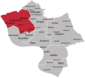
Karte Haldern in Rees.svg 1,130 × 1,030; 26 KB
-
Karte Mehr in Rees.svg 1,130 × 1,030; 24 KB
-
Karte Millingen in Rees.svg 1,130 × 1,030; 26 KB
-
Karte Rees gesamt.svg 1,130 × 1,030; 26 KB
-
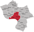
Karte Rees in Rees.svg 1,130 × 1,030; 26 KB
-
Knotenpunkt 57 - Karte.jpg 2,268 × 4,032; 3.88 MB
-
Knotenpunkt 59 Niedermörmter Karte.jpg 2,268 × 4,032; 1.22 MB
-
Lageplan Haus Aspel 1733.jpg 1,074 × 1,561; 1.09 MB
-
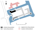
Lageplan Schloss Hueth.svg 810 × 700; 24 KB
-
Rees in KLE.svg 438 × 619; 292 KB


