Category:Maps of Recurt (Hautes-Pyrénées)
Jump to navigation
Jump to search
Wikimedia category | |||||
| Upload media | |||||
| Instance of | |||||
|---|---|---|---|---|---|
| Category combines topics | |||||
| Recurt | |||||
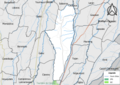
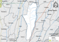
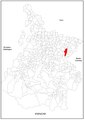
commune in Hautes-Pyrénées, France _1.jpg) .svg) _OSM_01.png) | |||||
| Instance of | |||||
| Location |
| ||||
| Population |
| ||||
| Area |
| ||||
| Elevation above sea level |
| ||||
 | |||||
Subcategories
This category has the following 3 subcategories, out of 3 total.
Media in category "Maps of Recurt (Hautes-Pyrénées)"
The following 11 files are in this category, out of 11 total.
-
 65376-Recurt - Localisation.png 2,000 × 2,480; 1.03 MB
-
 65376-Recurt-argile.jpg 3,057 × 2,480; 616 KB
-
 65376-Recurt-Hydro.png 7,015 × 4,960; 6.29 MB
-
 65376-Recurt-Natura 2000.png 7,015 × 4,960; 5.07 MB
-
 65376-Recurt-Orthophoto.png 7,015 × 4,960; 19.51 MB
-
 65376-Recurt-Sols.png 7,015 × 4,960; 6.59 MB
-
 65376-Recurt-ZNIEFF1.png 7,015 × 4,960; 5.26 MB
-
 65376-Recurt-ZNIEFF2.png 7,015 × 4,960; 5.09 MB
-
 Localisation de Recurt dans les Hautes-Pyrénées 1.pdf 1,754 × 2,481; 617 KB
-
 Map commune FR insee code 65376.png 756 × 605; 55 KB
-
 Recurt (Hautes-Pyrénées) OSM 01.png 318 × 597; 258 KB


