Category:Maps of Rémécourt
Jump to navigation
Jump to search
Wikimedia category | |||||
| Upload media | |||||
| Instance of | |||||
|---|---|---|---|---|---|
| Category combines topics | |||||
| Rémécourt | |||||
commune in Oise, France   | |||||
| Instance of | |||||
| Location | |||||
| Population |
| ||||
| Area |
| ||||
 | |||||
Subcategories
This category has only the following subcategory.
G
- Geological maps of Rémécourt (3 F)
Media in category "Maps of Rémécourt"
The following 4 files are in this category, out of 4 total.
-
 60529-Rémécourt-Hydro.jpeg 5,846 × 4,133; 867 KB
-
 60529-Rémécourt-Sols.png 3,270 × 2,598; 745 KB
-
 Map commune FR insee code 60529.png 756 × 605; 23 KB
-
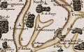 Rémécourt carte de cassini.jpg 585 × 361; 46 KB


