Category:Maps of Queensland Roads
Jump to navigation
Jump to search
Maps and diagrams of roads in Queensland (any category of road)
Media in category "Maps of Queensland Roads"
The following 48 files are in this category, out of 48 total.
-
 Balonne Highway 1912.svg 448 × 285; 436 KB
-
 Bamaga Road 0316.svg 673 × 680; 131 KB
-
 Barkly Highway 0116.svg 1,329 × 531; 141 KB
-
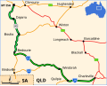
 Barwon Highway 2112.svg 249 × 158; 430 KB
-
 Birdsville Developmental Road.svg 726 × 493; 167 KB
-
 Bowen Developmental Road 0117.svg 877 × 594; 146 KB
-
 Brisbane Valley Highway 0116.svg 524 × 879; 117 KB
-
 Bulloo Developmental Road 091215.svg 601 × 428; 115 KB
-
 Bunya Highway 150116 ed.svg 313 × 425; 69 KB
-
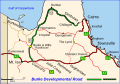 Burke Developmental Road.svg 552 × 382; 135 KB
-
 Burnett Highway 1912.svg 287 × 321; 439 KB
-
 Capricorn Highway 1312.svg 387 × 140; 409 KB
-
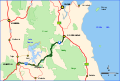
 Captain Cook Highway 1412.svg 573 × 386; 183 KB
-
 Cooper Developmental Road 912.svg 388 × 241; 65 KB
-
 Cunningham Highway 0216.svg 740 × 374; 130 KB
-
 D'Aguilar Highway 2112.svg 375 × 233; 422 KB
-
 Dawson Highway 2112.svg 380 × 234; 452 KB
-
 Diamantina Developmental Road - Map.svg 572 × 458; 88 KB
-
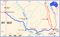 Donohue Highway 0216.svg 737 × 457; 247 KB
-
 Eyre Developmental Road 0816.svg 531 × 712; 148 KB
-
 Fitzroy Developmental Road 0117.svg 503 × 519; 393 KB
-
 Flinders Highway 1612.svg 553 × 335; 421 KB
-
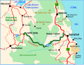
 Gillies Range Road 0318.svg 1,312 × 882; 178 KB
-
 Gore Highway 0116.svg 493 × 400; 71 KB
-
 Gregory Highway 1112.svg 300 × 378; 416 KB
-
 Gulf Developmental Road.png 894 × 639; 182 KB
-
 Isis Highway 0116.svg 465 × 337; 91 KB
-
 Kennedy Highway and Developmental road 1012.svg 379 × 401; 416 KB
-
 Landsborough Highway 1812.svg 544 × 497; 426 KB
-
 Leichhardt Highway 1612.svg 319 × 405; 427 KB
-
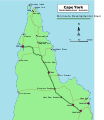 Map of Cape York - Peninsula Developmental Road.svg 2,131 × 2,462; 147 KB
-
 Moonie Highway 0117.svg 777 × 532; 154 KB
-
 Moonie Highway 1812.svg 243 × 159; 426 KB
-
 Mount Lindesay Highway.svg 409 × 376; 132 KB
-
 Mulligan Highway 1512.svg 708 × 854; 202 KB
-
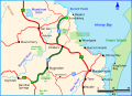
 Palmerston Highway 0116.svg 514 × 397; 86 KB
-
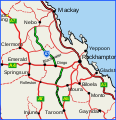
 Peak Downs Hwy.png 478 × 357; 87 KB
-
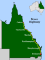 QLD-BruceHwy-Gaz.png 600 × 795; 53 KB
-
 Queensland roads.svg 846 × 1,040; 406 KB
-
 Queenslandroads fr.PNG 550 × 720; 32 KB
-
 Savannah Way 0216.svg 876 × 362; 102 KB
-
 State Strategic Touring Routes in Queensland, Australia.png 1,654 × 2,318; 2.09 MB
-
 Surat Developmental Road 0117.svg 777 × 532; 149 KB
-
 Suttor Developmental Road 0117.svg 877 × 594; 168 KB
-
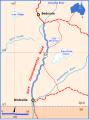
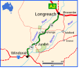 Thomson Developmental Road.svg 1,202 × 1,024; 116 KB
-
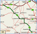
 Warrego Highway 1712.svg 647 × 456; 424 KB
-
 Wide Bay Highway 0116.svg 395 × 273; 79 KB
-
 Wills Developmental Road 0316.svg 515 × 447; 140 KB


