Category:Maps of Puerto Montt
Jump to navigation
Jump to search
Media in category "Maps of Puerto Montt"
The following 12 files are in this category, out of 12 total.
-
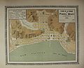
 Puerto-montt-MC0007490.pdf 3,202 × 2,612; 2.74 MB
-
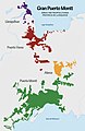
 Area Metropolitana del Gran Puerto Montt.png 993 × 1,539; 761 KB
-
 Comuna de Puerto Montt.svg 400 × 600; 263 KB
-
 Comuna Puerto Montt.png 318 × 600; 65 KB
-
 ETH-BIB-Karte Llanquihué, Todos Santo, Nahuel Huapi-Dia 247-12339.tif 3,876 × 2,700; 10.07 MB
-
 Gran Puerto Montt.jpg 1,432 × 2,334; 462 KB
-
 GRANPUERTOMONTTHD.jpg 1,440 × 2,303; 474 KB
-
 GranPuertoMonttMap.jpg 1,080 × 1,664; 226 KB
-
 MirasolEnPtoMontt.png 1,080 × 1,080; 770 KB
-
 Plano de Puerto Montt 1859.jpg 4,578 × 3,162; 1.95 MB
-
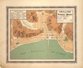
 Puerto Montt 1896 Plano Nicanor Bolona.jpg 2,228 × 1,820; 691 KB
-
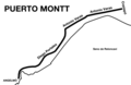 Trazado tranvias Puerto Montt.png 1,178 × 768; 93 KB


