Category:Maps of Przemyśl
Jump to navigation
Jump to search
Wikimedia category | |||||
| Upload media | |||||
| Instance of | |||||
|---|---|---|---|---|---|
| Category combines topics | |||||
| Przemyśl | |||||
city in southeastern Poland | |||||
| Instance of |
| ||||
| Location | |||||
| Head of government |
| ||||
| Significant event |
| ||||
| Population |
| ||||
| Area |
| ||||
| Different from | |||||
| official website | |||||
 | |||||
Subcategories
This category has the following 3 subcategories, out of 3 total.
C
O
- Outdoor maps of Przemyśl (1 F)
Media in category "Maps of Przemyśl"
The following 25 files are in this category, out of 25 total.
-
General.governement.map.1943.jpg 690 × 709; 771 KB
-
Greckokatolicka Metropolia Polska.PNG 370 × 370; 8 KB
-
Mapa Przemysl.png 395 × 396; 8 KB
-
Mapa przemysl.png 6,000 × 4,756; 2.4 MB
-
Podział Przemyśla na osiedla.svg 4,615 × 3,179; 37 KB
-
Podział Przemyśla na parafie.svg 4,405 × 3,562; 26 KB
-
POL Przemyśl map.svg 497 × 463; 47 KB
-
Położenie Kruhela Wielkiego w Przemyślu.svg 3,000 × 3,000; 23 KB
-
Położenie Osiedla Rycerskiego w Przemyślu.svg 3,000 × 3,000; 23 KB
-
Położenie Winnej Góry w Przemyślu.svg 3,000 × 3,000; 23 KB
-
Położenie Zasania na planie Przemyśla.svg 3,000 × 3,000; 23 KB
-
Przemysl County.png 321 × 278; 49 KB
-
Przemysl Mapa.png 580 × 425; 8 KB
-
Przemysl Voivodship 1975.png 474 × 437; 8 KB
-
Przemyśl 2010 zarys.svg 429 × 364; 11 KB
-
Przemyśl location map.png 633 × 510; 287 KB
-
Twierdza Przemysl-hu.svg 2,054 × 1,123; 230 KB
-
Twierdza Przemysl.svg 2,020 × 1,100; 264 KB
-
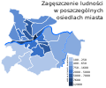
Zagęszczenie ludności Przemyśla.svg 3,669 × 3,054; 30 KB
-
Zarys Przemyśla.svg 3,000 × 3,000; 23 KB
-
Plan miasta Przemysla - z nowoprzemianowanemi i projektowanemi ulicami 1933 (73853326).jpg 19,439 × 24,377; 67.15 MB
-
Plan miasta Przemysla z drugiej polowy XVII wieku. 1883 (34030128).jpg 4,842 × 3,734; 3.65 MB
-
Владиче. Перемишль. Vladyče. Peremyšľ.jpg 806 × 452; 314 KB
-
Владиче. Перемишль. Мапа.jpg 372 × 344; 117 KB
-
Перемишль. Вигляд з кінця XVII століття.jpg 1,672 × 1,053; 1.45 MB


