Category:Maps of Plouégat-Guérand
Jump to navigation
Jump to search
Wikimedia category | |||||
| Upload media | |||||
| Instance of | |||||
|---|---|---|---|---|---|
| Category combines topics | |||||
| Plouégat-Guérand | |||||
commune in Finistère, France _Mairie.jpg)  | |||||
| Pronunciation audio | |||||
| Instance of | |||||
| Location |
| ||||
| Head of government |
| ||||
| Population |
| ||||
| Area |
| ||||
| official website | |||||
 | |||||
Media in category "Maps of Plouégat-Guérand"
The following 3 files are in this category, out of 3 total.
-
 29182-Plouégat-Guérand-Hydro.jpeg 5,846 × 4,133; 2.66 MB
-
 29182-Plouégat-Guérand-Sols.png 3,270 × 2,598; 2.9 MB
-
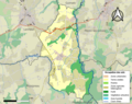
 Map commune FR insee code 29182.png 756 × 605; 74 KB

