Category:Maps of Phitsanulok
Jump to navigation
Jump to search
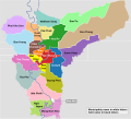
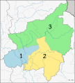
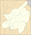
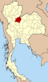
English: Phitsanulok (Thai: พิษณุโลก) is one of the provinces (changwat) of Thailand, located in the North of Thailand.
Subcategories
This category has the following 4 subcategories, out of 4 total.
Media in category "Maps of Phitsanulok"
The following 34 files are in this category, out of 34 total.
-
 Amphoe 6501.png 390 × 443; 17 KB
-
 Amphoe 6501.svg 1,595 × 1,772; 186 KB
-
 Amphoe 6502.png 390 × 443; 18 KB
-
 Amphoe 6502.svg 1,595 × 1,772; 191 KB
-
 Amphoe 6503.png 390 × 443; 17 KB
-
 Amphoe 6503.svg 1,595 × 1,772; 188 KB
-
 Amphoe 6504.png 390 × 443; 17 KB
-
 Amphoe 6504.svg 1,595 × 1,772; 184 KB
-
 Amphoe 6505.png 390 × 443; 17 KB
-
 Amphoe 6505.svg 1,595 × 1,772; 182 KB
-
 Amphoe 6506.png 390 × 443; 17 KB
-
 Amphoe 6506.svg 1,595 × 1,772; 185 KB
-
 Amphoe 6507.png 390 × 443; 17 KB
-
 Amphoe 6507.svg 1,595 × 1,772; 185 KB
-
 Amphoe 6508.png 390 × 443; 17 KB
-
 Amphoe 6508.svg 1,595 × 1,772; 190 KB
-
 Amphoe 6509.png 390 × 443; 17 KB
-
 Amphoe 6509.svg 1,595 × 1,772; 185 KB
-
 Amphoe Phitsanulok.png 520 × 590; 17 KB
-
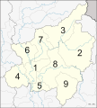 Amphoe Phitsanulok.svg 1,595 × 1,772; 192 KB
-
 Communities of Phitsanulok 1 EN.svg 2,746 × 1,913; 240 KB
-
 Communities of Phitsanulok 2 EN.svg 2,746 × 1,913; 220 KB
-
 Communities of Phitsanulok 3 EN.svg 2,746 × 2,232; 240 KB
-
 Communities of Phitsanulok 4 EN.svg 2,746 × 2,232; 245 KB
-
 Communities of Wang Thong. Phitsanulok.svg 886 × 744; 27 KB
-
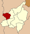
 Districts Phitsanulok province.png 1,595 × 1,772; 497 KB
-
 Mueang Phitsanulok district EN.svg 3,047 × 2,764; 194 KB
-
 Municipal Areas in Phitsanulok Province EN.png 1,596 × 1,772; 517 KB
-
 Municipal Areas in Phitsanulok Province TH.png 1,596 × 1,772; 515 KB
-
 Phitsanulok PESA.svg 1,595 × 1,772; 200 KB
-
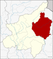
 Thailand Phitsanulok location map.svg 1,595 × 1,772; 169 KB
-
 Thailand Phitsanulok locator map.svg 1,052 × 1,849; 1.2 MB
-
 Thailand Phitsanulok.png 178 × 300; 14 KB
-
 Tham Rue (Boat Cave).JPG 3,264 × 2,448; 2.55 MB


.JPG)