Category:Maps of Peru by Mariano Paz Soldán
Jump to navigation
Jump to search
Subcategories
This category has only the following subcategory.
Media in category "Maps of Peru by Mariano Paz Soldán"
The following 37 files are in this category, out of 37 total.
-
 123 of 'Historia del Perú independiente' (11084251985).jpg 1,682 × 2,851; 1.46 MB
-
 Arica-calientes.gif 592 × 933; 460 KB
-
 Carta hidrografica del Peru - por Mariano Felipe Paz. Soldan - btv1b53025186x.jpg 8,561 × 11,847; 14.18 MB
-
 Carta oro-hidrografica del Peru - por Mariano Felipe Paz Soldan - btv1b530253266.jpg 8,564 × 11,828; 18.47 MB
-
 Chincha map 1865.png 1,501 × 2,057; 5.34 MB
-
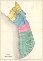 Departamento moquegua 1865.JPG 5,706 × 8,146; 30.04 MB
-
 Fortaleza de Sacsahuaman; Plano antiguo del Cuzco (cropped).png 4,495 × 2,137; 13.7 MB
-
 Fortaleza de Sacsahuaman; Plano antiguo del Cuzco.png 5,302 × 6,810; 47.15 MB
-
 Guadalupe-Motupe.jpg 334 × 1,000; 140 KB
-
 L-Mariani-and-M-Paz-Soldan-Callao-topografico.jpeg 6,848 × 5,171; 6.38 MB
-
 Llocllapampa.png 714 × 500; 958 KB
-

-
 Mapa del Peru - por Mariano Felipe Paz Soldan... - btv1b530249783.jpg 8,521 × 11,745; 19.11 MB
-
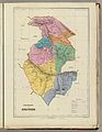
 MFPS-D-ancachs.jpg 5,390 × 6,804; 6.17 MB
-
 MFPS-D-arequipa.jpg 6,792 × 5,235; 6.14 MB
-
 MFPS-D-Ayacucho.jpg 5,198 × 6,710; 5.69 MB
-
 MFPS-D-ayacucho.jpg 6,747 × 5,242; 5.9 MB
-
 MFPS-D-Cajamarca.jpg 5,390 × 6,804; 6.15 MB
-
 MFPS-D-Cuzco.jpg 6,880 × 10,277; 12.02 MB
-
 MFPS-D-Huancavelica.jpg 6,774 × 5,275; 5.11 MB
-
 MFPS-D-junin.jpg 6,876 × 8,124; 10.32 MB
-
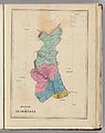
 MFPS-D-lalibertad.jpg 5,390 × 6,804; 5.85 MB
-
 MFPS-D-Lima.jpg 5,390 × 6,804; 6.14 MB
-
 MFPS-D-loreto.jpg 9,090 × 12,724; 20.96 MB
-
 MFPS-D-Mapa General del Peru, 1865.jpg 7,552 × 10,709; 17.1 MB
-
 MFPS-D-moquegua.jpg 6,848 × 9,540; 11.41 MB
-
 MFPS-D-Piura.jpg 5,390 × 6,804; 6.6 MB
-
 MFPS-D-Puno.jpg 6,837 × 8,584; 8.21 MB
-
 Motupe.gif 558 × 908; 409 KB
-
 Pasco-concepcion.png 1,363 × 924; 985 KB
-
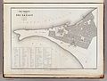
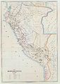 PERU MAPA 1865.JPG 6,556 × 9,208; 3.31 MB
-
 PERU MAPA2800px 1865.JPG 2,800 × 3,933; 1.97 MB
-
 Plano y vista de las Islas de Chincha.tif 5,200 × 6,843; 60.33 MB
-
 San Pablo, Peru.png 1,000 × 388; 776 KB
-
 Sierra-y-costa-peruana-desde-huamachuco-a-acotambo1500.png 1,500 × 4,338; 12.89 MB
-
 Tacna y Arica 1865.JPG 1,308 × 1,716; 985 KB
-

.jpg)


.png)


