Category:Maps of Paris in the 1600s
Jump to navigation
Jump to search
Subcategories
This category has the following 3 subcategories, out of 3 total.
M
- Map of Paris by François Quesnel (11 F)
V
Media in category "Maps of Paris in the 1600s"
The following 10 files are in this category, out of 10 total.
-
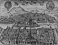
 110 of 'Paris. Histoire-monuments-administration-environs, etc' (11198047924).jpg 1,321 × 1,942; 716 KB
-
 ParisCharlesV.jpg 1,600 × 1,242; 802 KB
-
 Damien de Templeux, Le gouvernement de l'Isle de France, 1600-1620 - Gallica.jpg 9,251 × 7,513; 18.46 MB
-
 Ile de la cite 1609.jpg 640 × 480; 251 KB
-

-

-

-
 Île aux Vaches & île Notre-Dame, Plan de Vassalieu ca. 1609.jpg 727 × 614; 812 KB
-
 Île Louviers, Plan de Vassalieu ca. 1609.jpg 680 × 429; 511 KB
-
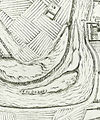 Île Maquerelle, Plan de Paris en 1609.jpg 759 × 908; 877 KB
.jpg)


