Category:Maps of Paris from the Norman B. Leventhal Map Center
Jump to navigation
Jump to search
Subcategories
This category has only the following subcategory.
T
Media in category "Maps of Paris from the Norman B. Leventhal Map Center"
The following 96 files are in this category, out of 96 total.
-
 Bradshaw's plan of Paris, and map of the environs - Norman B. Leventhal Map Center.jpg 5,012 × 4,158; 4.65 MB
-
 Bradshaw's plan of Paris, and map of the environs - Norman B. Leventhal Map Center.tif 5,012 × 4,158; 59.65 MB
-
 Carte du Vexin Beauvoisis et Hurepoix 1634.jpg 8,789 × 6,592; 34.74 MB
-
 Carte du Vexin Beauvoisis et Hurepoix 1634.tif 8,789 × 6,592; 165.79 MB
-
 Carte routière des environs de Paris... - Norman B. Leventhal Map Center.jpg 7,722 × 5,419; 9.96 MB
-
 Carte routière des environs de Paris... - Norman B. Leventhal Map Center.tif 7,722 × 5,419; 119.75 MB
-
 Environs de Paris - Norman B. Leventhal Map Center.jpg 5,459 × 4,088; 4.98 MB
-
 Environs de Paris - Norman B. Leventhal Map Center.tif 5,459 × 4,088; 63.87 MB
-
 Exposition universelle de 1867 a Paris - Norman B. Leventhal Map Center.jpg 6,504 × 8,632; 5.91 MB
-
 Exposition universelle de 1867 a Paris - Norman B. Leventhal Map Center.tif 6,504 × 8,632; 160.65 MB
-

-

-
 Galignani's plan of Paris and environs - Norman B. Leventhal Map Center.jpg 6,039 × 4,536; 6.54 MB
-
 Galignani's plan of Paris and environs - Norman B. Leventhal Map Center.tif 6,039 × 4,536; 78.4 MB
-
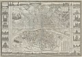
 Illustrated map of Paris - Norman B. Leventhal Map Center.jpg 6,521 × 4,759; 5.13 MB
-
 Illustrated map of Paris - Norman B. Leventhal Map Center.tif 6,521 × 4,759; 88.81 MB
-
 Junié, Plan des paroisses de Paris avec la distinction des parties eparses qui de dépendent.jpg 18,771 × 13,734; 75.03 MB
-
 Junié, Plan des paroisses de Paris avec la distinction des parties eparses qui de dépendent.tif 18,771 × 13,734; 737.61 MB
-
 L'Isle de France et lieux circövoysins - Norman B. Leventhal Map Center.tif 5,207 × 3,941; 58.74 MB
-
 L'Isle de France et lieux circövoysins.jpg 5,207 × 3,941; 10.04 MB
-

-

-
 Nicolas Sanson, Diocese, prevoste, et eslection de Paris, 1660.jpg 9,182 × 6,773; 22.47 MB
-
 Nicolas Sanson, Diocese, prevoste, et eslection de Paris, 1660.tif 9,182 × 6,773; 177.96 MB
-
 Nouveau Paris monumental - Norman B. Leventhal Map Center.jpg 8,594 × 6,609; 8.98 MB
-
 Nouveau Paris monumental - Norman B. Leventhal Map Center.tif 8,594 × 6,609; 162.53 MB
-
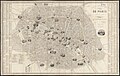
 Nouveau plan de Paris divisé en 12 arrondissements - Norman B. Leventhal Map Center.jpg 6,564 × 4,462; 5.9 MB
-
 Nouveau plan de Paris divisé en 12 arrondissements - Norman B. Leventhal Map Center.tif 6,564 × 4,462; 83.82 MB
-
 Nouveau plan de Paris fortifié - Norman B. Leventhal Map Center.jpg 6,912 × 4,738; 7.99 MB
-
 Nouveau plan de Paris fortifié - Norman B. Leventhal Map Center.tif 6,912 × 4,738; 93.72 MB
-
 Nouveau plan de Paris ou guide des étrangers - Flickr.jpg 2,000 × 1,550; 3.89 MB
-
 Nouveau plan de Paris ou guide des étrangers - Norman B. Leventhal Map Center, original.jpg 7,263 × 5,629; 39.03 MB
-
 Nouveau plan de Paris ou guide des étrangers - Norman B. Leventhal Map Center.tif 7,263 × 5,629; 117 MB
-
 Nouveau plan illustré de la ville de Paris, 1847 - Norman B. Leventhal Map Center.jpg 8,593 × 6,682; 13.06 MB
-
 Nouveau plan illustré de la ville de Paris, 1847 - Norman B. Leventhal Map Center.tif 8,593 × 6,682; 164.3 MB
-
 Nouveau plan illustré de la ville de Paris, 1852 - Norman B. Leventhal Map Center.jpg 8,596 × 6,693; 13.09 MB
-
 Nouveau plan illustré de la ville de Paris, 1852 - Norman B. Leventhal Map Center.tif 8,596 × 6,693; 164.63 MB
-
 Nouveau plan illustré de la ville de Paris, 1858 - Norman B. Leventhal Map Center.jpg 8,621 × 6,716; 12.65 MB
-
 Nouveau plan illustré de la ville de Paris, 1858 - Norman B. Leventhal Map Center.tif 8,621 × 6,716; 165.68 MB
-
 Nouveau plan itinéraire de la ville de Paris... 1836 - Norman B. Leventhal Map Center.jpg 6,840 × 4,642; 8.34 MB
-
 Nouveau plan itinéraire de la ville de Paris... 1836 - Norman B. Leventhal Map Center.tif 6,840 × 4,642; 90.87 MB
-
 Nouveau plan itinéraire de la ville de Paris... 1837 - Norman B. Leventhal Map Center.jpg 6,798 × 4,702; 8.05 MB
-
 Nouveau plan itinéraire de la ville de Paris... 1837 - Norman B. Leventhal Map Center.tif 6,798 × 4,702; 91.47 MB
-

-

-
 Nouveau plan routier de la ville et faubourgs de Paris, ca. 1801–1802 - Norman B. Leventhal Map Center.jpg 17,002 × 11,864; 116.99 MB
-
 Nouveau plan routier de la ville et faubourgs de Paris, ca. 1801–1802 - Norman B. Leventhal Map Center.tif 17,002 × 11,864; 577.12 MB
-
 Paris illustré et ses fortifications - Norman B. Leventhal Map Center.jpg 6,143 × 4,313; 5.93 MB
-
 Paris illustré et ses fortifications - Norman B. Leventhal Map Center.tif 6,143 × 4,313; 75.83 MB
-
 Paris monumental et ses environs - Norman B. Leventhal Map Center.jpg 5,256 × 4,192; 3.99 MB
-
 Paris monumental et ses environs - Norman B. Leventhal Map Center.tif 5,256 × 4,192; 63.06 MB
-
 Pictorial map of the city of Paris and its environs - Norman B. Leventhal Map Center.tif 8,205 × 6,195; 145.46 MB
-
 Pictorial map of the city of Paris and its environs.jpg 8,205 × 6,195; 25.42 MB
-
 Plan de la Riviere de Seine dans Paris, 1760 - Norman B. Leventhal Map Center.tif 4,192 × 3,400; 40.81 MB
-
 Plan de la Riviere de Seine dans Paris, 1760.jpg 4,192 × 3,400; 6.35 MB
-
 Plan de la ville de Paris nouvellement dressé - Norman B. Leventhal Map Center.jpg 6,600 × 4,990; 7.73 MB
-
 Plan de la ville de Paris nouvellement dressé - Norman B. Leventhal Map Center.tif 6,600 × 4,990; 94.25 MB
-
 Plan de la ville de Paris, divisé en 12 arrondissemts - Flickr.jpg 2,000 × 1,349; 2.98 MB
-

-
 Plan de la ville de Paris, divisé en 12 arrondissemts - Norman B. Leventhal Map Center.tif 7,626 × 5,145; 112.28 MB
-

-

-
 Plan de la ville et faubourgs de Paris, divisé en 12 mairies - Flickr.jpg 2,000 × 1,347; 2.87 MB
-

-
 Plan de la ville et faubourgs de Paris, divisé en 12 mairies - Norman B. Leventhal Map Center.tif 8,763 × 5,903; 148.02 MB
-
 Plan de Paris avec les projets de percements - Flickr.jpg 2,000 × 1,431; 3.09 MB
-
 Plan de Paris avec les projets de percements - Norman B. Leventhal Map Center, original.jpg 7,740 × 5,537; 46.67 MB
-
 Plan de Paris avec les projets de percements - Norman B. Leventhal Map Center.tif 7,740 × 5,537; 122.64 MB
-
 Plan des paroisses de Paris avec la distinction des parties eparses qui de dépendent.jpg 17,114 × 11,305; 78.78 MB
-
 Plan du Bois de Boulogne - Norman B. Leventhal Map Center.jpg 6,442 × 9,068; 10.59 MB
-
 Plan du Bois de Boulogne - Norman B. Leventhal Map Center.tif 6,442 × 9,068; 167.15 MB
-

-

-
 Plan géométral de Paris et de ses fauxbourgs - Norman B. Leventhal Map Center.jpg 7,434 × 5,188; 39.71 MB
-
 Plan géométral de Paris et de ses fauxbourgs - Norman B. Leventhal Map Center.tif 7,434 × 5,188; 110.37 MB
-
 Plan pittoresque de la ville de Paris - Flickr.jpg 2,000 × 1,270; 2.5 MB
-
 Plan pittoresque de la ville de Paris - Norman B. Leventhal Map Center, original.jpg 8,132 × 5,164; 38.24 MB
-
 Plan pittoresque de la ville de Paris - Norman B. Leventhal Map Center.tif 8,132 × 5,164; 120.17 MB
-
 Plan routier de la ville de Paris et de ses faubourgs.jpg 10,000 × 7,056; 39.68 MB
-
 Plan routier de la ville de Paris et de ses faubourgs.tif 10,000 × 7,056; 201.9 MB
-
 Plan routier de la ville et fauxbourgs de Paris - Flickr.jpg 2,000 × 1,346; 3.43 MB
-
 Plan routier de la ville et fauxbourgs de Paris - Norman B. Leventhal Map Center, original.jpg 9,924 × 6,677; 66.76 MB
-
 Plan routier de la ville et fauxbourgs de Paris - Norman B. Leventhal Map Center.tif 9,924 × 6,677; 189.6 MB
-
 Plan von Paris und seinen festungswerken - Norman B. Leventhal Map Center.jpg 5,581 × 4,324; 4.98 MB
-
 Plan von Paris und seinen festungswerken - Norman B. Leventhal Map Center.tif 5,581 × 4,324; 69.07 MB
-

-

-
 Russell's map of Paris and fortifications - Norman B. Leventhal Map Center.jpg 6,594 × 4,684; 4.73 MB
-
 Russell's map of Paris and fortifications - Norman B. Leventhal Map Center.tif 6,594 × 4,684; 88.39 MB
-
 Testard, Aspect général de Paris 2, 1860.jpg 9,056 × 5,899; 28.28 MB
-
 Testard, Aspect général de Paris, 1860 - Norman B. Leventhal Map Center.tif 9,056 × 5,899; 152.87 MB
-
 Testard, Aspect général de Paris, 1860.jpg 8,662 × 5,555; 24.21 MB
-
 Vieux Paris et ses monuments - Norman B. Leventhal Map Center.jpg 5,970 × 4,876; 6.4 MB
-
 Vieux Paris et ses monuments - Norman B. Leventhal Map Center.tif 5,970 × 4,876; 83.31 MB
-

-


