Category:Maps of Palestine in 12th century
Jump to navigation
Jump to search
Subcategories
This category has only the following subcategory.
J
Media in category "Maps of Palestine in 12th century"
The following 7 files are in this category, out of 7 total.
-
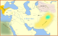
 Seljuk Empire locator map.svg 800 × 488; 161 KB
-
 1187 Kingdom Of Jerusalem based on 1889 map (fa).jpg 512 × 880; 210 KB
-
 1187 Kingdom Of Jerusalem based on 1889 map-es.svg 512 × 880; 495 KB
-
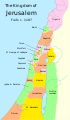 1187 Kingdom Of Jerusalem based on 1889 map.svg 512 × 880; 207 KB
-
 Map Crusader states 1190-de.svg 978 × 1,330; 332 KB
-
 Seljuq Empire1100. he.svg 642 × 396; 254 KB
-
 Seljuq Empire1100.svg 642 × 396; 253 KB

.jpg)


